Community
- Forums Home
- >
- Revit Products Community
- >
- Revit Architecture Forum
- >
- Revit 2019 toposurface model size
Revit Architecture Forum
Welcome to Autodesk’s Revit Architecture Forums. Share your knowledge, ask questions, and explore popular Revit Architecture topics.
Turn on suggestions
Auto-suggest helps you quickly narrow down your search results by suggesting possible matches as you type.
Reply
Topic Options
- Subscribe to RSS Feed
- Mark Topic as New
- Mark Topic as Read
- Float this Topic for Current User
- Bookmark
- Subscribe
- Printer Friendly Page
Message 1 of 28
08-29-2018
09:16 AM
- Mark as New
- Bookmark
- Subscribe
- Mute
- Subscribe to RSS Feed
- Permalink
- Report
08-29-2018
09:16 AM
Does Revit handle large topo models well? I have a 3D toposurface for a site of about 1500 feet by 1500 feet about roughly 0.2 square miles.
The topo was generated directly from a Civil link of topo contours: https://knowledge.autodesk.com/support/revit-products/learn-explore/caas/CloudHelp/cloudhelp/2016/EN...
It looks like everything is ok since the file being otherwise a few sheets and site elements is around 600 MB now. Anyone has had similar experiences with topo models being large model files or taking up system resources?
I am using Revit 2019.1.
Solved! Go to Solution.
Solved by thakopian. Go to Solution.
Solved by FAIR59. Go to Solution.
27 REPLIES 27
Message 2 of 28
08-29-2018
09:55 AM
- Mark as New
- Bookmark
- Subscribe
- Mute
- Subscribe to RSS Feed
- Permalink
- Report
Message 3 of 28
08-29-2018
10:02 AM
- Mark as New
- Bookmark
- Subscribe
- Mute
- Subscribe to RSS Feed
- Permalink
- Report
08-29-2018
10:02 AM
The CAD is a linked model. I can remove the link instance but even then the file size is large.
600 MB for a mostly empty model is excessive and I haven't seen this before.
Image of my Site with Topo:
Message 4 of 28
08-29-2018
10:17 AM
- Mark as New
- Bookmark
- Subscribe
- Mute
- Subscribe to RSS Feed
- Permalink
- Report
08-29-2018
10:17 AM
I agree. But, there's something else going on. Can you purge and audit file?
Message 5 of 28
08-29-2018
11:49 AM
- Mark as New
- Bookmark
- Subscribe
- Mute
- Subscribe to RSS Feed
- Permalink
- Report
08-29-2018
11:49 AM
Audited, Purged and Compacted the model File size reduced to 200 MB but it is still larger than expected.
You see, when I created this model with toposurface it was under 100 MB.
The file had sheets added to it but most of the modeling was topography adjustments.
I then took it a step further with a detached copy.
The toposurface model was removed along with most model elements then purged and compacted again.
It ended up being 193 MB which means some kind of data is in the model that can't be removed through deletion or purging. I think this hidden content might be the core of the inflated file size. It likely has something to do with the toposurface modeling.
Is there a way to find what the left over data is?
Message 6 of 28
08-29-2018
12:01 PM
- Mark as New
- Bookmark
- Subscribe
- Mute
- Subscribe to RSS Feed
- Permalink
- Report
08-29-2018
12:01 PM
So you're saying that when the Toposurface is removed, the file decreases 7 MB in size, but the remaining file size is 93 MB larger than you think it should be?
Message 7 of 28
08-29-2018
12:08 PM
- Mark as New
- Bookmark
- Subscribe
- Mute
- Subscribe to RSS Feed
- Permalink
- Report
08-29-2018
12:08 PM
Yeah that's where I am at right now. Take everything away from the model. I would expect maximum 100 MB size due to remaining loaded families and legacy content.
Should be closer to 20 MB but I don't have a reference just my expectation based on experience.
One note to make is that this was originally a 2018 model the toposurface was created in.
The entire model was upgraded to 2019 which seemed like it worked fine.
Maybe the upgrade had something to do with it since everything was normal while in 2018 and we started seeing issues in 2019. Could be a coincidence.
Message 8 of 28
08-29-2018
12:11 PM
- Mark as New
- Bookmark
- Subscribe
- Mute
- Subscribe to RSS Feed
- Permalink
- Report
08-29-2018
12:11 PM
Yah, something weird is going on here. Let's call in some muscle. @Viveka_CD!!!
Message 9 of 28
08-29-2018
01:16 PM
- Mark as New
- Bookmark
- Subscribe
- Mute
- Subscribe to RSS Feed
- Permalink
- Report
08-29-2018
01:16 PM
Hi @thakopian
Can you share a file to test further?
Regards,
Viveka CD
Designated Specialist - AEC, AR/VR Research
Autodesk playlists| Find Recommended Hardware| System requirements for Revit products| Contact Autodesk Support| Autodesk Virtual Agent| Browse Revit Ideas| Revit Tips/Tricks| Revit Help| Revit Books

Message 10 of 28
08-29-2018
02:40 PM
- Mark as New
- Bookmark
- Subscribe
- Mute
- Subscribe to RSS Feed
- Permalink
- Report
08-29-2018
02:40 PM
I tried to upload with the Forum post but the model was too large to be accepted.
Here's a shared folder from Google Drive that has the entire model:
https://drive.google.com/open?id=1jlbwyKhFWzWTZSu68GtjPBx1WlKmn3JN
Message 11 of 28
08-29-2018
02:45 PM
- Mark as New
- Bookmark
- Subscribe
- Mute
- Subscribe to RSS Feed
- Permalink
- Report
Message 12 of 28
08-29-2018
02:47 PM
- Mark as New
- Bookmark
- Subscribe
- Mute
- Subscribe to RSS Feed
- Permalink
- Report
Message 13 of 28
08-29-2018
03:02 PM
- Mark as New
- Bookmark
- Subscribe
- Mute
- Subscribe to RSS Feed
- Permalink
- Report
08-29-2018
03:02 PM
Holy cow again! Who did this DWG anyway? There's a lot of junk in it. Plus, virtually every element in it is on a layer named "TOPO"-something! Hard to know which are the index and intermediate contours. Did you specify layers to use when you created your Topo?
..."TOPO" Layer Insanity! Here's how she looks in Revit, using just the layers with the prefix "TOPO".

Message 14 of 28
08-29-2018
03:07 PM
- Mark as New
- Bookmark
- Subscribe
- Mute
- Subscribe to RSS Feed
- Permalink
- Report
08-29-2018
03:07 PM
It's a busy DWG. Aerial survey reporting to CAD.
I generated from the layesr TOPO-INTER and TOPO-INDEX.
The rest were for non-grading references like curbs and trees.
Message 15 of 28
08-29-2018
03:17 PM
- Mark as New
- Bookmark
- Subscribe
- Mute
- Subscribe to RSS Feed
- Permalink
- Report
08-29-2018
03:17 PM
Okay, so TOPO-INTER and TOPO-INDEX isn't showing hardly any relief. The Topo is virtually flat. Other than that; unless you expoded this DWG in your project, I don't see any issues that could be caused by using it in a RVT project. So, I'm still stumped.
Message 16 of 28
08-29-2018
03:22 PM
- Mark as New
- Bookmark
- Subscribe
- Mute
- Subscribe to RSS Feed
- Permalink
- Report
08-29-2018
03:22 PM
Didn't explode the DWG. Just linked it in and generated from the two layers mentioned.
It is a fairly flat grading of the site so the geometry isn't anything complicated.
However. We did use a dynamo script to take the toposurface and modify the sub element of some floors to create topo sidewalks.
That may have had an affect but we are not sure.
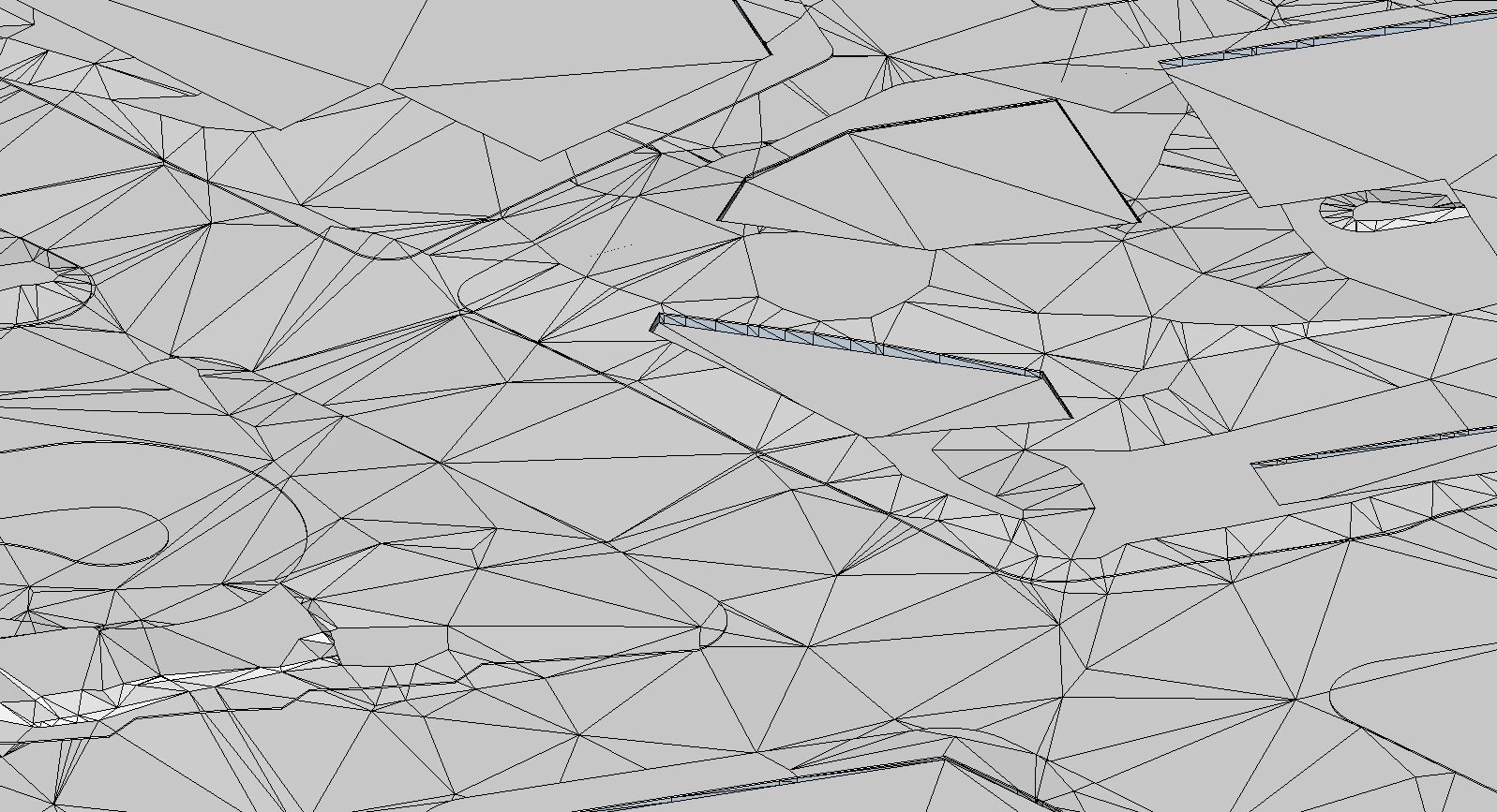
An example of the current topo (in the model link I created) shows a lot more triangulation. I have an image attached.
That conversion of the toposurface into the floor family sub elements could have had an effect.
Perhaps adding a lot of points and making the model more complex.
Message 17 of 28
08-29-2018
08:28 PM
- Mark as New
- Bookmark
- Subscribe
- Mute
- Subscribe to RSS Feed
- Permalink
- Report
08-29-2018
08:28 PM
@thakopian wrote:
An example of the current topo (in the model link I created) shows a lot more triangulation.
That's a result of the "Triangulation Edges" Subcategory (under Topography) being turned on. It could impact on performance, but not file size.
Message 18 of 28
08-29-2018
09:09 PM
- Mark as New
- Bookmark
- Subscribe
- Mute
- Subscribe to RSS Feed
- Permalink
- Report
08-29-2018
09:09 PM
That's the thing. I simplified the contours in the topo model which improved responsiveness and performance to a degree. However that is when the file size increased.
The timeline from the start:
1. Model creation from Template - 5 MB
2. Toposurface generated from DWG link - 100 MB
3. Floor sub elements updated with toposurface contours with Dynamo script - 300 MB
4. Simplifying the contours - 600 MB
5. Auditing and Compacting the model - 592 MB
I get the feeling the floor modification had something to do with all this but not sure what.
in any case it is just the site with the topographic elements and a few sheets it is not a complex model.
Not sure what would cause the file size to inflate. That's why I think there's some kind of hidden data that needs editing.
The question is how to find it and clear it out if possible.
Message 19 of 28
08-29-2018
09:22 PM
- Mark as New
- Bookmark
- Subscribe
- Mute
- Subscribe to RSS Feed
- Permalink
- Report
Message 20 of 28
08-29-2018
10:19 PM
- Mark as New
- Bookmark
- Subscribe
- Mute
- Subscribe to RSS Feed
- Permalink
- Report
08-29-2018
10:19 PM
Script is select model element (topo subregion) > topography.poits > floor.slabshapebypoints
the floor input is whichever floor you want to match the points.
It's based on this tutorial at 4 nodes long: https://www.youtube.com/watch?v=BMB6a3Xd4-k
Screenshot:

Granted the example for this video was a small path and I was using floors that were several acres in size.
Don't know if that scale and the resulting points in the floors would have a negative effect though.
Reply
Topic Options
- Subscribe to RSS Feed
- Mark Topic as New
- Mark Topic as Read
- Float this Topic for Current User
- Bookmark
- Subscribe
- Printer Friendly Page
Forums Links
Can't find what you're looking for? Ask the community or share your knowledge.
Post to forums

