@hliS658H wrote:
Which positioning option do you think makes the most sense and you normally use to link survey?
If you know what the overall extent of the DWG file is before linking AND you know that it is close the AutoCAD's origin (rarely happens with civil files) then you could use Auto - Origin to Origin. Since civil and landscape files are rarely ever close to the AutoCAD origin it is recommended to use Auto - Center to Center like the other replies recommend. Once you Acquire Coordinates from that file then Revit and it (DWG file) are in sync. As mentioned earlier do this in a specific view assigned to Project North and leave this view alone afterward. Then anytime the file is reloaded it will stay put.
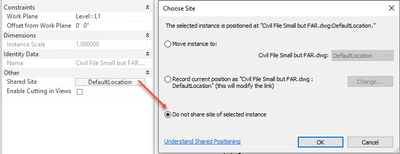
Also after using Acquire Coordinates, select the DWG and disable shared coordinates for the DWG so Revit doesn't attempt to store a Named UCS in the file. It's a bit counterintuitive but because we usually move the DWG around to get it into position around the building Revit thinks it needs a UCS that AutoCAD can use to align any exports to DWG from Revit. Exporting to DWG using Shared Coordinates eliminates the necessity for that. If you exported using Project Coordinates then it would be "helpful".
Steve Stafford
Did you find this post helpful? Feel free to Like this post.
Did your question get successfully answered? Then click on the ACCEPT SOLUTION button.