

Forums Links
Can't find what you're looking for? Ask the community or share your knowledge.
 This page has been translated for your convenience with an automatic translation service. This is not an official translation and may contain errors and inaccurate translations. Autodesk does not warrant, either expressly or implied, the accuracy, reliability or completeness of the information translated by the machine translation service and will not be liable for damages or losses caused by the trust placed in the translation service.
Translate
This page has been translated for your convenience with an automatic translation service. This is not an official translation and may contain errors and inaccurate translations. Autodesk does not warrant, either expressly or implied, the accuracy, reliability or completeness of the information translated by the machine translation service and will not be liable for damages or losses caused by the trust placed in the translation service.
Translate
In the process of transitioning to Civil 3D from GeoPak, and the main downside I see is the loss of our most used analysis tool. In GeoPak it is called the "Height / Slope" tool.
Something like this in Civil 3D would be amazingly helpful.
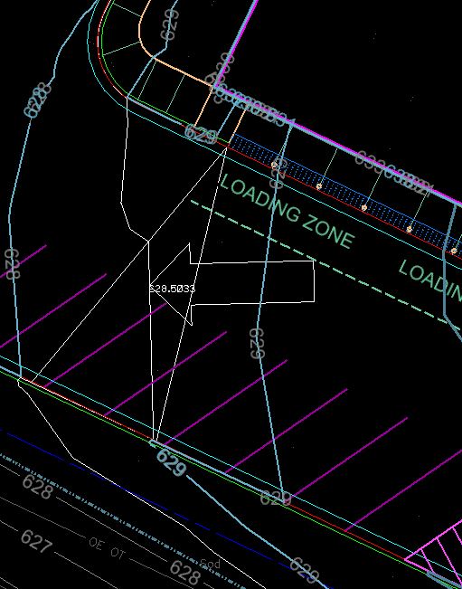
When you have it enabled, there are 3 options for the display.
1- Everywhere you move your cursor shows the contour line for the elevation you are over.
2- Option to show the triangle determining the slope just for where the cursor is.
3- A large arrow points in the direction of flow.
Any/all of the above can be on at once.
The tool window gives you the x, y, and z coordinates along with the percent slope.
See attached photos for the window and default display in a model.
This is incredibly helpful for checking a grading model as well as seeing where your overflow point is from one drainage basin to the next.
Wherever that contour line goes from one closed shape to opening into another area is the first place the water will overflow. Will the water back up into the building or downhill to the next inlet? This is a really quick and effective way to figure that out all without adding any lines or text to your model.
Can't find what you're looking for? Ask the community or share your knowledge.