Assign coordinate system
- Mark as New
- Bookmark
- Subscribe
- Mute
- Subscribe to RSS Feed
- Permalink
- Report
Hi
I am trying to create a new coordinate system for my country R. Macedonia with the following parameters:
The data on the geodetic date in which the topographic maps are made are:
- Spatial Reference System: State Macedonian Coordinate System,
- reference ellipsoid: Bessel 1841,
- equatorial radius (a): 6377397.155 m.,
-polar radius (b): 6356078.963 m.,
- inverse flattening f : 299.1528128156, 1 / f =0.003342773154
- cartographic projection: Gauss Krüger,
- Reflection zone: 7,
- the initial meridian: Greenwich,
- centered meridian: 21º 00'00 ",
- Beginner trainer: Equator,
- Size factor along the central meridian: 0.9999,
- value of Y along the central meridian: 7500000 m,
- the value of X along the initial compartment: 0 m,
- Unit: meter,
- Horizontal date: Hermannskogel, and
- vertical date: middle sea level.
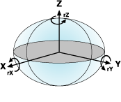
-a way of transformation (WGS1984 -> Bessel) Versa-wolf
- Transformation parameters
dx = -521.7476m,
dy = -229.4892m,
dz = -590.9207m
rx = 4.02878 ",
ry = 4.48836 ",
rz = -15.52067 "
s = 9.7803 ppm
- the width of the meridian zone 3 °
Please help with instructions of total process.
Regards