Community
Civil 3D Forum
Welcome to Autodesk’s Civil 3D Forums. Share your knowledge, ask questions, and explore popular AutoCAD Civil 3D topics.
Turn on suggestions
Auto-suggest helps you quickly narrow down your search results by suggesting possible matches as you type.
Reply
Topic Options
- Subscribe to RSS Feed
- Mark Topic as New
- Mark Topic as Read
- Float this Topic for Current User
- Bookmark
- Subscribe
- Printer Friendly Page
- « Previous
-
- 1
- 2
- Next »
Message 1 of 35
Anonymous
7682 Views, 34 Replies
05-14-2012
08:06 PM
- Mark as New
- Bookmark
- Subscribe
- Mute
- Subscribe to RSS Feed
- Permalink
- Report
05-14-2012
08:06 PM
Civil 3d 2013 Bugs / Glitches
Been working on C3D 2013 for a few weeks - not sure if anyone else is having these problems:
- When zooming in/out using mouse wheel, cad doesn’t recognize past the first scroll intellizoom and places hundreds of ‘group of commands’ where the single zoom should be noted as ‘one’ intellizoom. (Settings are set to combine pan & zooms). The undo command limit is reached during a short drawing session due to this. This is a major issue for me.

- When isolating a polyline (and deselecting a feature line or other object) – autocad crashes.
- Can’t print the model network plan view from ssa – it has a code error everytime.
- Display of masked object (surface labels) in layout tab viewports (dark brown color behind text) issue.
- When editing quick properties in cui, upon exiting, the toolbars are moved off-screen on the left side adj to docked ‘properties’ (they’re locked).
- Unable to read the Object Data from the selected Autocad entity error pops up randomly, but doesn't affect anything.
- In layout tab with a rotated viewport – ortho reverts back to original ucs during move/copy command while zooming in/out.
34 REPLIES 34
Message 21 of 35
Anonymous
in reply to:
Anonymous
08-16-2012
09:52 AM
- Mark as New
- Bookmark
- Subscribe
- Mute
- Subscribe to RSS Feed
- Permalink
- Report
08-16-2012
09:52 AM
I've lost the ability to display NE coordinate point labels in 2013, it will show the point style but not my text label.
Did it all the time in C3D2012 but its not happening in C3D2013.
It's there in the properties dialog box with all the values but will not display on my screen.
I've check layers on, tried different fonts and sizes, made sure "true was toggle where it needed to be in the label style,
the correct coordinate system was active in drawing properties, UCS world was correct, transparency settings etc..I'm at a lost....
Message 23 of 35
08-16-2012
03:13 PM
- Mark as New
- Bookmark
- Subscribe
- Mute
- Subscribe to RSS Feed
- Permalink
- Report
08-16-2012
03:13 PM
There's also the usual problem... For every bug Autodesk fixes in each release, they seem to introduce at least one more. Very frustrating. Especially considering every release is incompatible, and many people are forced to work in multiple releases, in order to collaborate with other companies. It's very hard to keep track of what bugs are in what releases.
Sinc
Message 24 of 35
Anonymous
in reply to:
Anonymous
10-07-2012
08:37 PM
- Mark as New
- Bookmark
- Subscribe
- Mute
- Subscribe to RSS Feed
- Permalink
- Report
10-07-2012
08:37 PM
Add to those:
1. tilted Cube with coordinate systems assigned to the drawing. the Cube shows sometimes as bottom even if it is the top.
2. Surface Legend Tables do not update dynamically when the surface data changes.
3. Viewport Type Choice does not work.
4. Civil 3D objects do not use transparency anymore, so no more overlays with imagery for surfaces analysis.
5. Dragged State for arrows thru the xref does not change based on the styles.
There are more, but could not think about them all at this moment of night 🙂
Web: www.civildigest.com Twitter: @C3DIsh
Message 25 of 35
11-16-2012
04:59 PM
- Mark as New
- Bookmark
- Subscribe
- Mute
- Subscribe to RSS Feed
- Permalink
- Report
11-16-2012
04:59 PM
I have also experienced several issue listed so far. Here is another: I edit a DWT (specifically Parts Lists), save, exit. Upon reopen, all the changes have been lost. No errors or warnings were given when I closed the DWT. There seems to be a SAVE bug. Maybe related to this topic: http://forums.autodesk.com/t5/AutoCAD-Civil-3D/Data-Shortcut-Error-2011/td-p/2682434
Message 26 of 35
11-19-2012
05:43 AM
- Mark as New
- Bookmark
- Subscribe
- Mute
- Subscribe to RSS Feed
- Permalink
- Report
11-19-2012
05:43 AM
Are you talking about the pipe networks parts list? If so, I believe that is not saved in the template, but in a separate file.
The command AECCSETNETWORKCATALOG will check which file each machine is pointed to.
Mark Green
Working on Civil 3D in Canada![]()
Message 27 of 35
11-19-2012
07:25 AM
- Mark as New
- Bookmark
- Subscribe
- Mute
- Subscribe to RSS Feed
- Permalink
- Report
11-19-2012
07:25 AM
Parts lists are stored in the drawing. Parts catalogs are not.
Message 28 of 35
Anonymous
in reply to:
Anonymous
02-20-2013
03:08 PM
- Mark as New
- Bookmark
- Subscribe
- Mute
- Subscribe to RSS Feed
- Permalink
- Report
02-20-2013
03:08 PM
I got logitech to send an old copy of the software that includes the 'middle button' option. It works great in 2013 for panning!
Message 29 of 35
03-21-2013
11:16 AM
- Mark as New
- Bookmark
- Subscribe
- Mute
- Subscribe to RSS Feed
- Permalink
- Report
03-21-2013
11:16 AM
I have issues with the layer properties manager. There are issues when creating new layers and renaming them in the properties manager. This worked flawlessly in C3D2010. Note that I experience this issue adding/renaming layers in a group filter view (my default work habit). I have not tried in the All Layers view.
-Jeff
Message 30 of 35
03-21-2013
01:59 PM
- Mark as New
- Bookmark
- Subscribe
- Mute
- Subscribe to RSS Feed
- Permalink
- Report
03-21-2013
01:59 PM
When working with Style based pen settings, feature lines and alignments that are externally referenced take on the xrefs layer plot style instead of the objects plot style. So a design can only have one lineweight once xrefed. So far only a problem with feature lines and alignments, surface styles are fine. Also does not matter if the style properties are set to ByLayer, ByBlock or a named plot style.
Archie Dodge
Applications Expert - Infrastructure Solutions Division
IMAGINiT Technologies
Applications Expert - Infrastructure Solutions Division
IMAGINiT Technologies
Message 31 of 35
Anonymous
in reply to:
Anonymous
05-31-2013
08:11 AM
- Mark as New
- Bookmark
- Subscribe
- Mute
- Subscribe to RSS Feed
- Permalink
- Report
05-31-2013
08:11 AM
This problem persists in c3d 2014 to zoom and scroll with the mouse wheel, this is annoying ... I thought that the 2014 version would fix this problem.
Message 32 of 35
11-12-2013
01:54 AM
- Mark as New
- Bookmark
- Subscribe
- Mute
- Subscribe to RSS Feed
- Permalink
- Report
11-12-2013
01:54 AM
You can use the button behind the wheel as middlebutton. When having no logitech driver installed that button is standard used by windows as middle button.
Grtz
Message 33 of 35
Anonymous
in reply to:
Anonymous
11-12-2013
06:28 AM
- Mark as New
- Bookmark
- Subscribe
- Mute
- Subscribe to RSS Feed
- Permalink
- Report
11-12-2013
06:28 AM
We're having a problem with a few of our PC's, and I'm not even sure were to begin describing it.
In various files, we seem to have a problem with AutoCAD reading data from either the Alignments for roads, or the Existing surfaces.
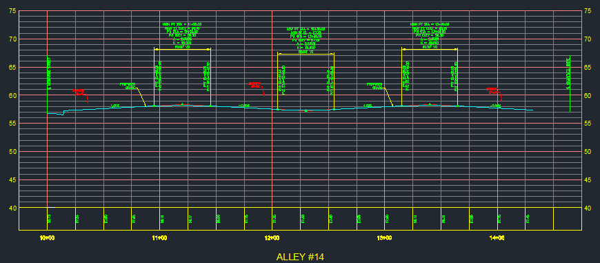
In some instances, 1 user can pull up the drawing, and everything shows up fine (see Grid-1 attachment)
They save, exit, and user 2 opens the same drawing. And gets an incomplete profile (see Grid-2)
Typically we're missing either existing or proposed grades, either existing or proposed elevation labels, and User 2 will be missing pipe data for Sanitary and Sewer systems.
We've been kicking this around for a while, and can't find the answer. If anyone else has an idea, please let me know.
Message 34 of 35
11-12-2013
06:47 AM
- Mark as New
- Bookmark
- Subscribe
- Mute
- Subscribe to RSS Feed
- Permalink
- Report
11-12-2013
06:47 AM
Are these items data shortcut into the drawing?
Are you getting a commandline message "Unable to locate project" when user 2 opens the drawing?
Are you getting a commandline message "Unable to locate project" when user 2 opens the drawing?
Mark Green
Working on Civil 3D in Canada![]()
Message 35 of 35
11-12-2013
06:56 AM
- Mark as New
- Bookmark
- Subscribe
- Mute
- Subscribe to RSS Feed
- Permalink
- Report
11-12-2013
06:56 AM
My understanding is that the pipe networks and roadway aligments and surfaces are drawn in a masterplan Roads drawing file.
The profiles are drawn in a profiles only drawing, with the pipe networks and surfaces data-referenced into the Profiles drawing.
There is not a command line error message.
There is however a Event list (see attached)
- « Previous
-
- 1
- 2
- Next »
Reply
Topic Options
- Subscribe to RSS Feed
- Mark Topic as New
- Mark Topic as Read
- Float this Topic for Current User
- Bookmark
- Subscribe
- Printer Friendly Page
- « Previous
-
- 1
- 2
- Next »
Forums Links
Can't find what you're looking for? Ask the community or share your knowledge.
Post to forums

