Community
- Forums Home
- >
- AutoCAD Map 3D Community
- >
- AutoCAD Map 3D Forum
- >
- Re: Bring csv file (with additional attributes) into Map
AutoCAD Map 3D Forum
Welcome to Autodesk’s AutoCAD Map 3D Forums. Share your knowledge, ask questions, and explore popular AutoCAD Map 3D topics.
Turn on suggestions
Auto-suggest helps you quickly narrow down your search results by suggesting possible matches as you type.
Bring csv file (with additional attributes) into Map
17 REPLIES 17
SOLVED
Reply
Topic Options
- Subscribe to RSS Feed
- Mark Topic as New
- Mark Topic as Read
- Float this Topic for Current User
- Bookmark
- Subscribe
- Printer Friendly Page
Message 1 of 18
05-14-2012
12:47 AM
- Mark as New
- Bookmark
- Subscribe
- Mute
- Subscribe to RSS Feed
- Permalink
- Report
05-14-2012
12:47 AM
I found this post which describes exactly what I want to do to get data into Map http://map3d.wordpress.com/2008/01/02/bring-a-csv-file-into-map-3d-with-data/ but I get stuck almost at the first hurdle (see screenshot).
Isn't there any easier way to get this data into Map??
Thanks
neilyj (No connection with Autodesk other than using the products in the real world)
Did you find this post helpful? Feel free to Like this post.
Did your question get successfully answered? Then click on the ACCEPT SOLUTION button.
AEC Collection 2025 UKIE (mainly Civil 3D UKIE and IW)
Win 11 Pro x64, 1Tb Primary SSD, 1Tb Secondary SSD
64Gb RAM Intel(R) Xeon(R) W-11855M CPU @ 3.2GHz
NVIDIA RTX A5000 16Gb, Dual 27" Monitor, Dell Inspiron 7760
Solved! Go to Solution.
17 REPLIES 17
Message 3 of 18
05-14-2012
09:18 AM
- Mark as New
- Bookmark
- Subscribe
- Mute
- Subscribe to RSS Feed
- Permalink
- Report
05-14-2012
09:18 AM
Hola creo que este link te puede ayudar http://usa.autodesk.com/adsk/servlet/ps/dl/item?siteID=123112&id=18307898&linkID=9240697
Message 4 of 18
05-14-2012
11:01 AM
- Mark as New
- Bookmark
- Subscribe
- Mute
- Subscribe to RSS Feed
- Permalink
- Report
05-14-2012
11:01 AM
Neily,
Murph's post was for the 2008 version - more functionality (i.e. the survey tab under mapwspace) has been added, but you can still follow through & use ODBC to connect to Excel. If using ODBC, you must use a named range in Excel and have the current 64bit excel driver.
If you're really stuck, send me a PM and I'll see what I can do to help walk you through it.
Todd Hepworth, P.E.
Message 5 of 18
05-14-2012
12:52 PM
- Mark as New
- Bookmark
- Subscribe
- Mute
- Subscribe to RSS Feed
- Permalink
- Report
05-14-2012
12:52 PM
Gracias por esto voy a echarle un vistazo (from Google translate....)
neilyj (No connection with Autodesk other than using the products in the real world)
Did you find this post helpful? Feel free to Like this post.
Did your question get successfully answered? Then click on the ACCEPT SOLUTION button.
AEC Collection 2025 UKIE (mainly Civil 3D UKIE and IW)
Win 11 Pro x64, 1Tb Primary SSD, 1Tb Secondary SSD
64Gb RAM Intel(R) Xeon(R) W-11855M CPU @ 3.2GHz
NVIDIA RTX A5000 16Gb, Dual 27" Monitor, Dell Inspiron 7760
Message 6 of 18
05-14-2012
12:55 PM
- Mark as New
- Bookmark
- Subscribe
- Mute
- Subscribe to RSS Feed
- Permalink
- Report
05-14-2012
12:55 PM
@Anonymous wrote:Neily,
Murph's post was for the 2008 version - more functionality (i.e. the survey tab under mapwspace) has been added, but you can still follow through & use ODBC to connect to Excel. If using ODBC, you must use a named range in Excel and have the current 64bit excel driver.
If you're really stuck, send me a PM and I'll see what I can do to help walk you through it.
Todd Hepworth, P.E.
Thanks Todd, I only have 32 bit Office so will need to look at the link in the post from jimyquick....
neilyj (No connection with Autodesk other than using the products in the real world)
Did you find this post helpful? Feel free to Like this post.
Did your question get successfully answered? Then click on the ACCEPT SOLUTION button.
AEC Collection 2025 UKIE (mainly Civil 3D UKIE and IW)
Win 11 Pro x64, 1Tb Primary SSD, 1Tb Secondary SSD
64Gb RAM Intel(R) Xeon(R) W-11855M CPU @ 3.2GHz
NVIDIA RTX A5000 16Gb, Dual 27" Monitor, Dell Inspiron 7760
Message 7 of 18
05-14-2012
12:58 PM
- Mark as New
- Bookmark
- Subscribe
- Mute
- Subscribe to RSS Feed
- Permalink
- Report
05-14-2012
12:58 PM
I also only have 32 bit office.
What I had to do was to uninstall office, install the 64-bit Access driver, reinstall 32-bit office over the 64-bit driver - you can't update the driver with 32-bit office on the machine.
Then use a named range in excel - this is critical.
Worked for me only after upgrading to 2012 - wouldn't work with C3D 2011 for ODBC to excel.
HTH!
Message 8 of 18
05-14-2012
02:59 PM
- Mark as New
- Bookmark
- Subscribe
- Mute
- Subscribe to RSS Feed
- Permalink
- Report
05-14-2012
02:59 PM
@neilyj666 wrote:I found this post which describes exactly what I want to do to get data into Map http://map3d.wordpress.com/2008/01/02/bring-a-csv-file-into-map-3d-with-data/ but I get stuck almost at the first hurdle (see screenshot).
Isn't there any easier way to get this data into Map??
Thanks
Yes with the newer version (2010 and up) Use the Mapimport and select the ASCII format, You may need to edit the CVS file a bit but that's one way with out ODBC.
Murph
Supporting the troops daily.

Supporting the troops daily.
Message 9 of 18
05-15-2012
02:30 AM
- Mark as New
- Bookmark
- Subscribe
- Mute
- Subscribe to RSS Feed
- Permalink
- Report
05-15-2012
02:30 AM
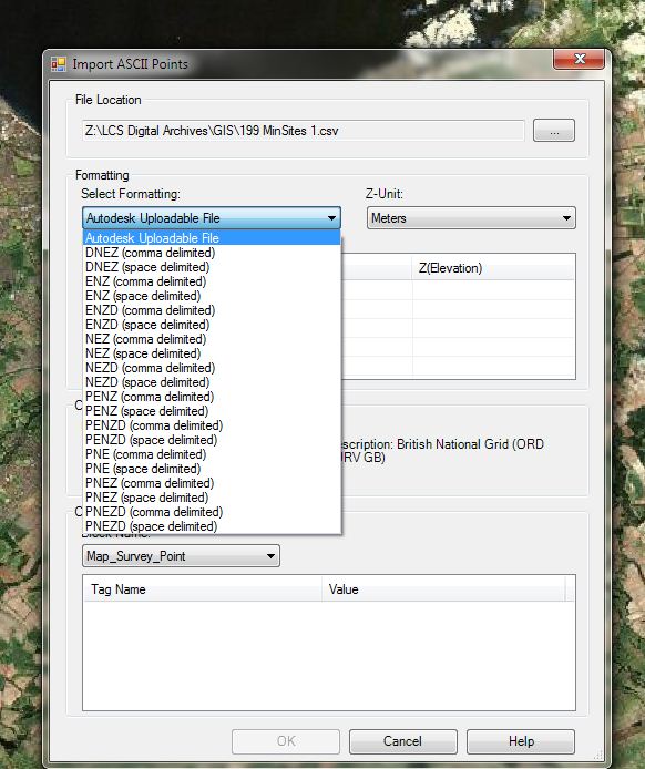
Thanks for this but when I try the ASCII file, there doesn't seem to be an option to change the input fields....
neilyj (No connection with Autodesk other than using the products in the real world)
Did you find this post helpful? Feel free to Like this post.
Did your question get successfully answered? Then click on the ACCEPT SOLUTION button.
AEC Collection 2025 UKIE (mainly Civil 3D UKIE and IW)
Win 11 Pro x64, 1Tb Primary SSD, 1Tb Secondary SSD
64Gb RAM Intel(R) Xeon(R) W-11855M CPU @ 3.2GHz
NVIDIA RTX A5000 16Gb, Dual 27" Monitor, Dell Inspiron 7760
Message 10 of 18
05-15-2012
05:14 AM
- Mark as New
- Bookmark
- Subscribe
- Mute
- Subscribe to RSS Feed
- Permalink
- Report
05-15-2012
05:14 AM
Neilyj, If you have C3D why not just use the Civil3D opint import tools and create the format you need? Once you import the the cvs as points do a export to Geospatial of that point group to SDF format.
Can you attach a few lines of the CVS file?
Murph
Supporting the troops daily.
Supporting the troops daily.
Message 11 of 18
05-15-2012
05:26 AM
- Mark as New
- Bookmark
- Subscribe
- Mute
- Subscribe to RSS Feed
- Permalink
- Report
05-15-2012
05:26 AM
I have tried this and the additional attributes are visible in C3D but the SDF export seems to ignore them. The lines below show the data I am tryingto work with - there are more fields in the full dataset but these are the main ones of interest at the moment
| |||||||||||||||||||||||||||||||||||||||||
neilyj (No connection with Autodesk other than using the products in the real world)
Did you find this post helpful? Feel free to Like this post.
Did your question get successfully answered? Then click on the ACCEPT SOLUTION button.
AEC Collection 2025 UKIE (mainly Civil 3D UKIE and IW)
Win 11 Pro x64, 1Tb Primary SSD, 1Tb Secondary SSD
64Gb RAM Intel(R) Xeon(R) W-11855M CPU @ 3.2GHz
NVIDIA RTX A5000 16Gb, Dual 27" Monitor, Dell Inspiron 7760
Message 12 of 18
05-15-2012
05:46 AM
- Mark as New
- Bookmark
- Subscribe
- Mute
- Subscribe to RSS Feed
- Permalink
- Report
05-15-2012
05:46 AM
@neilyj666 wrote:I have tried this and the additional attributes are visible in C3D but the SDF export seems to ignore them. The lines below show the data I am tryingto work with - there are more fields in the full dataset but these are the main ones of interest at the moment
#Pt E N Name Description Region 1 278200 647200 Canderigg Lochhead/Broomfield Sth. Lanarks 2 279100 648700 Woodside Colliery Sth. Lanarks 3 297900 689000 Bogside Mine West Fife 4 347300 709200 Highham Farm Radernie East Fife 5 280000 645700 East Draffan Sth. Lanarks
I'll tinker with it later today, got some boats engines to get running first. 🙂
Murph
Supporting the troops daily.
Supporting the troops daily.
Message 13 of 18
05-15-2012
07:19 AM
- Mark as New
- Bookmark
- Subscribe
- Mute
- Subscribe to RSS Feed
- Permalink
- Report
05-15-2012
07:19 AM
Neily,
I was able to connect to your data via FDO ODBC to Excel.
I've got the current 64-bit Access ODBC driver and 32-bit Office 2007.
From Excel - highlight all of your data & set up a "named range"
From the ODBC data sources in Control Panel, Create a DSN to the Excel workbook.
From Data Connect in Map/C3D, select the DSN from a FDO to ODBC.
You should see the named range & X/Y/Z columns - select your easting & northing & points should come into the workspace.
Update if you need more help... I didn't have to modify anything you posted regarding characters...
Best of Luck!
Message 14 of 18
05-15-2012
07:26 AM
- Mark as New
- Bookmark
- Subscribe
- Mute
- Subscribe to RSS Feed
- Permalink
- Report
05-15-2012
07:26 AM
Thanks for trying the odbc method - but this will mean an uninstall and reinstall of office 2007 which I'd prefer to avoid if at all possible
AEC Collection 2025 UKIE (mainly Civil 3D UKIE and IW)
Win 11 Pro x64, 1Tb Primary SSD, 1Tb Secondary SSD
64Gb RAM Intel(R) Xeon(R) W-11855M CPU @ 3.2GHz
NVIDIA RTX A5000 16Gb, Dual 27" Monitor, Dell Inspiron 7760
neilyj (No connection with Autodesk other than using the products in the real world)
Did you find this post helpful? Feel free to Like this post.
Did your question get successfully answered? Then click on the ACCEPT SOLUTION button.
AEC Collection 2025 UKIE (mainly Civil 3D UKIE and IW)
Win 11 Pro x64, 1Tb Primary SSD, 1Tb Secondary SSD
64Gb RAM Intel(R) Xeon(R) W-11855M CPU @ 3.2GHz
NVIDIA RTX A5000 16Gb, Dual 27" Monitor, Dell Inspiron 7760
Message 15 of 18
05-15-2012
07:30 AM
- Mark as New
- Bookmark
- Subscribe
- Mute
- Subscribe to RSS Feed
- Permalink
- Report
05-15-2012
07:30 AM
You are correct. However, when I uninstalled Office I was prepared with backing up all of my email/info to a .pst and thought I'd have to reload all of my messages/notes/calendar from it. Turned out not to be the case - everything was "as-is" prior to the installation. Dunno if this is because we're on a MS Exchange server, or if some of the settings are retained in the registry (or elsewhere) even with the uninstall (maybe uninstall not complete/clean???) Won't promise it would be the same for you, but was less painful that monkeying around with a VM..... the only other alternative I could think of for you.
Message 16 of 18
06-13-2012
08:24 AM
- Mark as New
- Bookmark
- Subscribe
- Mute
- Subscribe to RSS Feed
- Permalink
- Report
06-13-2012
08:24 AM
1. Get your pure data
2. Insert the data to your favorite spreadsheet (in this description I use Microsoft Excel)
3. Save your pure data to the CSV file called CSV (Comma delimited) but notice that you get a semicolon separator ( ; )
4. Create a new Point File Format in Autodesk Civil 3D and call it e.g. PEN(semicolon) with settings:
- Default file extension .csv
- Comment Tag #
- Format options Delimited by ;
5. Import the points to Autodesk Civil 3D from your CSV file
6. Choose Output and Export Civil Object to SDF Set your coordinate system in this example Arbitrary X-Y Coordinates (XY-BC) is used


7. Change the workspace to Autodesk Map 3D (Planning and Analysis)
8. Type a MAPWSPACE command and choose On
9. Connect to the SDF file
10. Choose Points data from Civil_Schema and press Add to Map
11. The Data Table is empty
12. Export Layer Data to SQLite


13. Open the Mozilla Firefox browser
14. Install Extension called SQLite Manager from Mozilla Add-Ons
15. From the Mozilla Firefox browser choose Web Developer and open SQLite Manager

16. Open the SQLite Points base exported by Autodesk Map 3D
17. Open the table called Points, select Stucture and copy the statement (mentioned below) to the notepad for future reuse in next steps:
CREATE TABLE "Points" ("Autogenerated_SDF_ID" INTEGER PRIMARY KEY, "Geometry" BLOB, "Name" TEXT, "Description" TEXT, "RawDescription" TEXT, "Number" INTEGER, "Elevation" REAL, "Latitude" TEXT, "Longitude" TEXT)
18. Select Points, choose Export Table and export the data to the CSV file Select the checkboxes: First row contains column names and Fields separated by Semicolon ( ; )
19. Select the exported Points table and delete it
20. Open the exported Points table form the CSV file format in Microsoft Excel
21. Change the column names and copy your data to these empty columns from the pure data CSV file
22. Save the edited CSV file as the CSV format file
23. Go back to SQLite Manager and import the edited CSV file
- Select First row containing column names
- Select Fields separated by Semicolon ( ; )


24. Set types of data for all columns from the information that you have saved in the notepad:
Autogenerated_SDF_ID -> INTEGER
Geometry - > BLOB
Name - > TEXT
… etc.
25. Save and Close SQLite Manager
26. Go Back to Autodesk Map 3D and connect to the re-edited SQLite database
27. Select Points and Add to Map
28. Finally you will get your points from Civil 3D with data from the CSV table, other words you have just inserted all pure data
If you check the result - geometry matches the description.


Message 17 of 18
06-13-2012
08:43 AM
- Mark as New
- Bookmark
- Subscribe
- Mute
- Subscribe to RSS Feed
- Permalink
- Report
06-13-2012
08:43 AM
CivilFF - Thanks for taking the time to produce the instructions and screen shots, I'll give it a try and see if I can get it to work.
Incidentally, it seems like we have to jump through several hoops to get any useful data exchange between Map and C3D - it really shouldn't be this involved should it??
neilyj (No connection with Autodesk other than using the products in the real world)
Did you find this post helpful? Feel free to Like this post.
Did your question get successfully answered? Then click on the ACCEPT SOLUTION button.
AEC Collection 2025 UKIE (mainly Civil 3D UKIE and IW)
Win 11 Pro x64, 1Tb Primary SSD, 1Tb Secondary SSD
64Gb RAM Intel(R) Xeon(R) W-11855M CPU @ 3.2GHz
NVIDIA RTX A5000 16Gb, Dual 27" Monitor, Dell Inspiron 7760
Message 18 of 18
06-15-2012
02:10 AM
- Mark as New
- Bookmark
- Subscribe
- Mute
- Subscribe to RSS Feed
- Permalink
- Report
06-15-2012
02:10 AM
Just worked through this and it worked like a charm - it's not a procedure you just stumble upon though....!!!!![]()
neilyj (No connection with Autodesk other than using the products in the real world)
Did you find this post helpful? Feel free to Like this post.
Did your question get successfully answered? Then click on the ACCEPT SOLUTION button.
AEC Collection 2025 UKIE (mainly Civil 3D UKIE and IW)
Win 11 Pro x64, 1Tb Primary SSD, 1Tb Secondary SSD
64Gb RAM Intel(R) Xeon(R) W-11855M CPU @ 3.2GHz
NVIDIA RTX A5000 16Gb, Dual 27" Monitor, Dell Inspiron 7760
Reply
Topic Options
- Subscribe to RSS Feed
- Mark Topic as New
- Mark Topic as Read
- Float this Topic for Current User
- Bookmark
- Subscribe
- Printer Friendly Page
Forums Links
Can't find what you're looking for? Ask the community or share your knowledge.
Post to forums
