Report Lat/Long/Elevation for a POI with a simple script
- Mark as New
- Bookmark
- Subscribe
- Mute
- Subscribe to RSS Feed
- Permalink
- Report
1) Make sure you have POIs in your model.
Note: Do not select any POIs before running the script. If a POI is selected when you run the script, the User Data field will not report Lat-Long-Elevation until you de-select and then re-select that POI.
2) Click  >
>  >
>  to open the Scripting Console.
3) Paste this script into the Scripting Area. See: To create and run scripts from the Scripting Console for more information.
function getCoordinate(feature) {
 var vector = feature.GEOMETRY.Centroid2d;
 var vector2 = feature.GEOMETRY.BBox3d.Center;
 if(vector == null) { return; }
 vector = app.ReprojectPointDbToLL84(vector);
 if(vector == null) { return; }
 var longitude = vector.X;
 var latitude = vector.Y;
 var elevation = vector2.Z
 return latitude + ", " + longitude + ", " + elevation;
}
var db = app.ActiveModelDb;
var classID = db.TableIndex("POIS");
var poisTable = db.Table(classID);
var poisRow = poisTable.GetWriteRow();
poisTable.StartQuery();
var row = poisTable.Next();
while(row){
 poisRow["USER_DATA"]=getCoordinate(row);
 var featureId=row.ID;
 poisTable.UpdateFeature(poisRow,featureId);
 print( "Feature "+featureId+" was updated.");
 row = poisTable.Next();
}
poisTable.EndQuery();
4) Click Start Script. You will be notified about how many POIs were updated. In this example, I have 3 POIs in my model, so 3 features were updated.
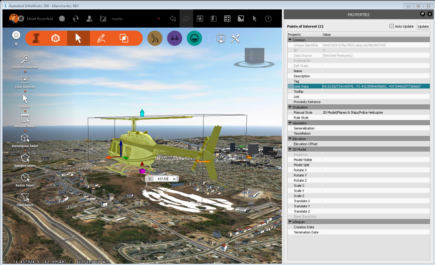
5) Select any POI. ( I am selecting the Helicopter POI that I sketched, just for fun).
6) Open the Properties Palette for that POI.
7) Lat-Long-Elevation for the selected POI will appear in the User Data field.
Note: The User Data field will report in Lat-Long-Elevation format, which switches the order of the X-Y values reported in the InfraWorks 360 status bar (bottom-left corner of the application window).
Principal Specialist, Infrastructure


