Community
InfraWorks Forum
Welcome to Autodesk’s InfraWorks Forums. Share your knowledge, ask questions, and explore popular InfraWorks topics.
Turn on suggestions
Auto-suggest helps you quickly narrow down your search results by suggesting possible matches as you type.
Reply
Topic Options
- Subscribe to RSS Feed
- Mark Topic as New
- Mark Topic as Read
- Float this Topic for Current User
- Bookmark
- Subscribe
- Printer Friendly Page
Message 1 of 6
08-01-2012
12:38 PM
- Mark as New
- Bookmark
- Subscribe
- Mute
- Subscribe to RSS Feed
- Permalink
- Report
08-01-2012
12:38 PM
I'm a bit confused. Does AIM always work in meters? I have a project set up to Colorado State Planes US Foot coordinate system, I have the units set to display in feet, my data source is in feet, but in the script for the building elevations, it shows as follows:
function Process(SOURCE, BUILDINGS) {
    BUILDINGS.EXTERNAL_ID = SOURCE["FeatId"];
    BUILDINGS.ROOF_HEIGHT = toMeter(5, (SOURCE["ROOF_ELEV"]-SOURCE["GRND_ELEV"]));
    BUILDINGS.ROOF_MATERIAL = "Material/Roofing/Aspahalt Grey";
    BUILDINGS.ROOF_SLOPE = 33;
    BUILDINGS.RULE_STYLE = "Facade/Brick/Biron";

    return true;
}
The BUILDINGS.ROOF_HIEGHT has the toMeters syntax. This is taking the elvations that are imperial, converting them to metric, then displaying them imperial when I select the properties of one of the buildings. Does that sound correct?
Thanks for any insight on this.
Solved! Go to Solution.
Solved by konstantin.baumann. Go to Solution.
5 REPLIES 5
Message 2 of 6
08-02-2012
01:00 AM
- Mark as New
- Bookmark
- Subscribe
- Mute
- Subscribe to RSS Feed
- Permalink
- Report
08-02-2012
01:00 AM
Yes, that is correct. All length values stored in the internal model DB are stored in "meters".
Konstantin.B
Software Architect
Message 3 of 6
02-27-2013
09:59 AM
- Mark as New
- Bookmark
- Subscribe
- Mute
- Subscribe to RSS Feed
- Permalink
- Report
02-27-2013
09:59 AM
I have similar confusion on units in AIM...
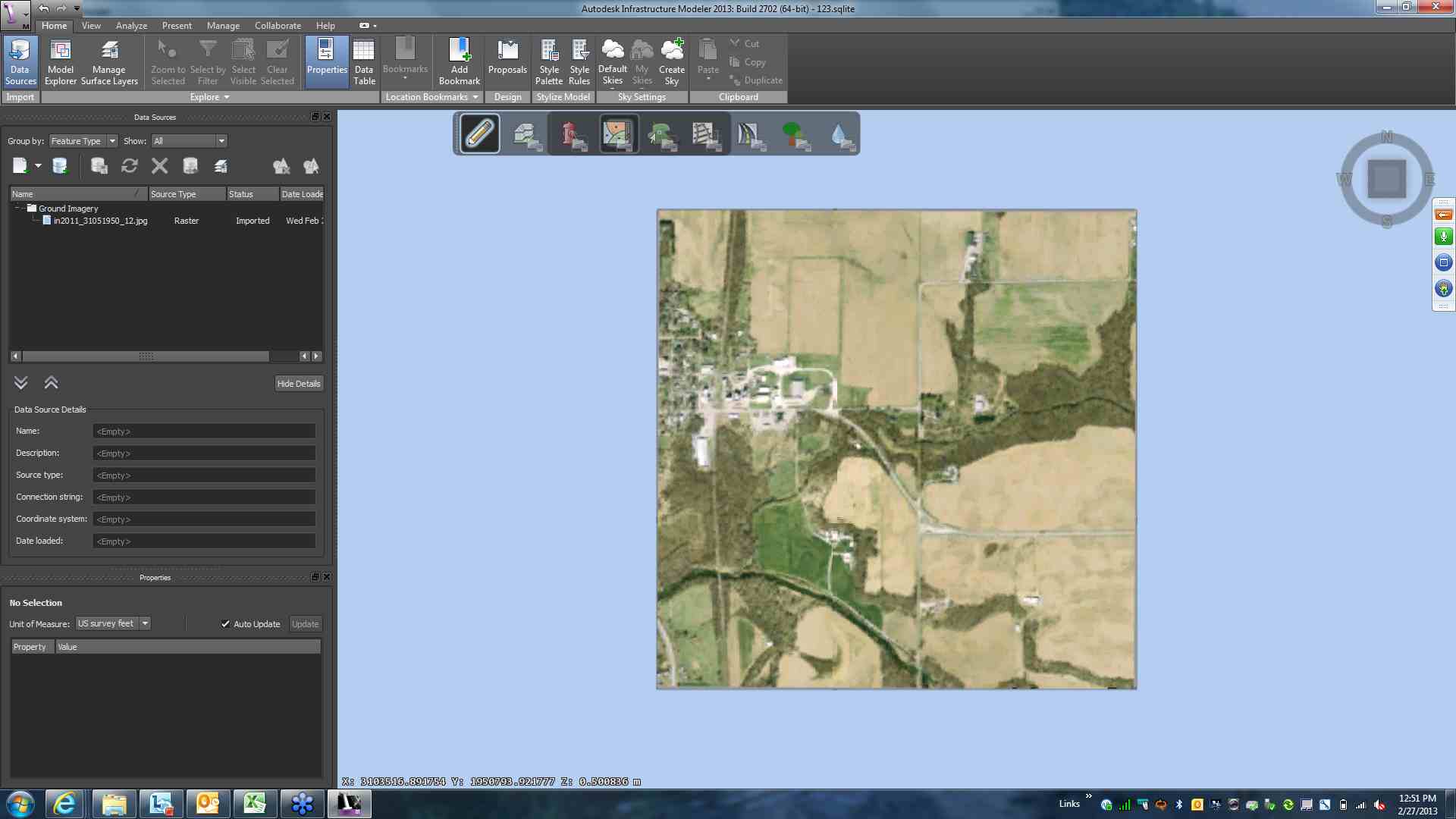
See attached screen clip. I have an image attached with a world file coord file. The units displaying in the model view of AIM show state plane coordinates with an "m" following the coords. It seems to indicate the coordinates displayed are meters. In fact the actual values appear to be Indiana State Plane west zone coordinates that are indeed where the actual image should be. SO... it appears the display is showing state plane feet coordinates, but the "m" seems to indicate meters.
Any help for an AIM rookie? Thanks!
Message 4 of 6
06-20-2013
07:47 AM
- Mark as New
- Bookmark
- Subscribe
- Mute
- Subscribe to RSS Feed
- Permalink
- Report
06-20-2013
07:47 AM
Hi - I'm really new to this and was going thru some of the steps in the training guide.
I just wanted to be sure that, no matter what datum my terrain file is in, it will always display in meters when imported?
Thanks, Bill
IDSP 2014
Message 5 of 6
06-20-2013
07:54 AM
- Mark as New
- Bookmark
- Subscribe
- Mute
- Subscribe to RSS Feed
- Permalink
- Report
06-20-2013
07:54 AM
The data is *stored* in meters; the *display* defaults to meters but you can change that by choosing another "user coordinate system" (UCS) in the model settings for the mouse coordinate tracker at the bottom left of the 3d canvas and the "unit settings" in the application options (for the display and editing of feature properties and style parameters).

Konstantin.B
Software Architect
Konstantin.B
Software Architect
Message 6 of 6
06-20-2013
08:09 AM
- Mark as New
- Bookmark
- Subscribe
- Mute
- Subscribe to RSS Feed
- Permalink
- Report
Reply
Topic Options
- Subscribe to RSS Feed
- Mark Topic as New
- Mark Topic as Read
- Float this Topic for Current User
- Bookmark
- Subscribe
- Printer Friendly Page

