Community
- Forums Home
- >
- AutoCAD Map 3D Community
- >
- AutoCAD Map 3D Forum
- >
- Turning on\off a shape files layer on viewport,
AutoCAD Map 3D Forum
Welcome to Autodesk’s AutoCAD Map 3D Forums. Share your knowledge, ask questions, and explore popular AutoCAD Map 3D topics.
Turn on suggestions
Auto-suggest helps you quickly narrow down your search results by suggesting possible matches as you type.
Reply
Topic Options
- Subscribe to RSS Feed
- Mark Topic as New
- Mark Topic as Read
- Float this Topic for Current User
- Bookmark
- Subscribe
- Printer Friendly Page
Message 1 of 6
11-29-2013
10:27 AM
- Mark as New
- Bookmark
- Subscribe
- Mute
- Subscribe to RSS Feed
- Permalink
- Report
11-29-2013
10:27 AM
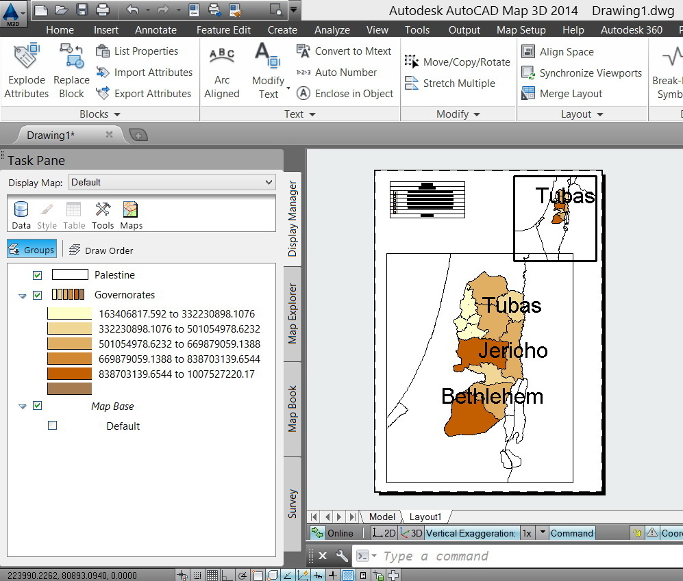
Turning on\off a shape files layer on viewport,
I couldn’t figure out why turning off a shape file layer in a particular viewport (attached) does turn it off in all other viewports
Thank you
Best
Jamal
---------------------------
Jamal Numan
Jamal Numan
Solved! Go to Solution.
Solved by Alfred.NESWADBA. Go to Solution.
5 REPLIES 5
Message 2 of 6
11-29-2013
10:37 AM
- Mark as New
- Bookmark
- Subscribe
- Mute
- Subscribe to RSS Feed
- Permalink
- Report
11-29-2013
10:37 AM
Hi,
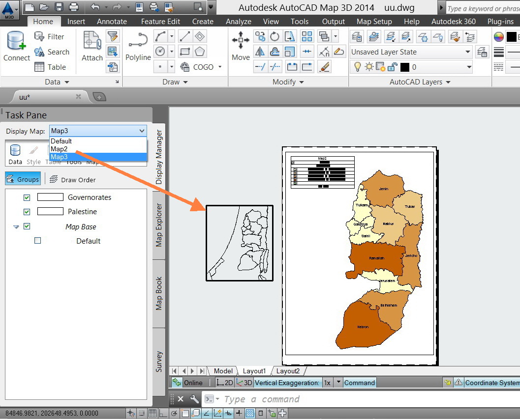
you can create different maps in the mapwspace (or use command _MAPNEWMAP), each of the maps may hold/show the same content or, like you want, in map1 show the shape and in map2 don't show it.
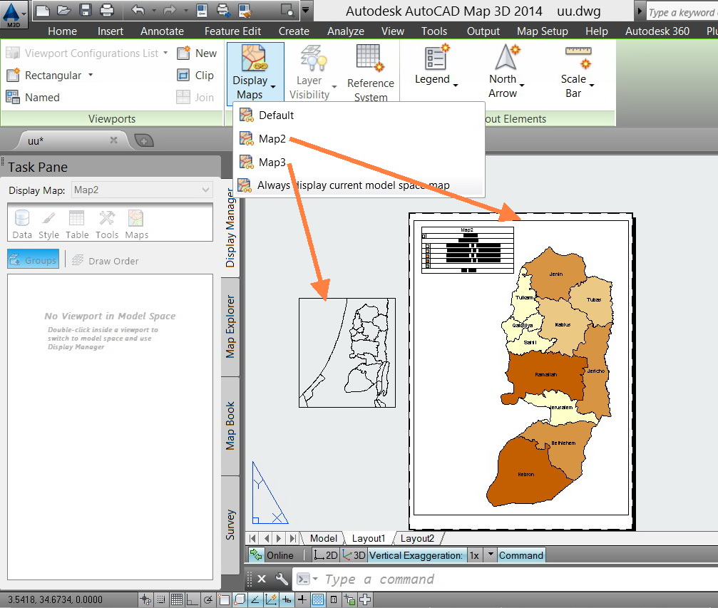
The next step is to assign map1 to viewport1 and map2 to viewport2 (using command _MAPASSOCVPWITHMAP), you get the ribbons with that functionality at the moment you switch to the layout (and you have a map-menu/workspace active).

- alfred -
------------------------------------------------------------------------------------
Alfred NESWADBA
Ingenieur Studio HOLLAUS ... www.hollaus.at ... blog.hollaus.at ... CDay 2024
------------------------------------------------------------------------------------
(not an Autodesk consultant)
Alfred NESWADBA
Ingenieur Studio HOLLAUS ... www.hollaus.at ... blog.hollaus.at ... CDay 2024
------------------------------------------------------------------------------------
(not an Autodesk consultant)
Message 3 of 6
11-29-2013
12:00 PM
- Mark as New
- Bookmark
- Subscribe
- Mute
- Subscribe to RSS Feed
- Permalink
- Report
11-29-2013
12:00 PM
Many thanks Alfred for the help,
Then everything is controlled by “maps” (attached). The issue now that I have no idea how to control maps
1. Rename\delete
2. Copy a layer (or multiple layers) from a map to another
Best
Jamal
---------------------------
Jamal Numan
Jamal Numan
Message 4 of 6
11-29-2013
12:09 PM
- Mark as New
- Bookmark
- Subscribe
- Mute
- Subscribe to RSS Feed
- Permalink
- Report
11-29-2013
12:09 PM
Hi,
>> The issue now that I have no idea how to control maps
Start command _MAPWSPACE to get the dialog for the main AutoCAD Map functionality:

Besides of the possibility to duplicate a map (so you have all the stylizations you already created for one map again in the new map) you always can save a gis-layer with right-click on the layer-name in the mapwspace-dialog, save it as .layer file, then drag and drop this .layer file to any other map you like to see it. That duplicates all the settings/stylizations you already set.
- alfred -
------------------------------------------------------------------------------------
Alfred NESWADBA
Ingenieur Studio HOLLAUS ... www.hollaus.at ... blog.hollaus.at ... CDay 2024
------------------------------------------------------------------------------------
(not an Autodesk consultant)
Alfred NESWADBA
Ingenieur Studio HOLLAUS ... www.hollaus.at ... blog.hollaus.at ... CDay 2024
------------------------------------------------------------------------------------
(not an Autodesk consultant)
Message 5 of 6
11-30-2013
05:35 AM
- Mark as New
- Bookmark
- Subscribe
- Mute
- Subscribe to RSS Feed
- Permalink
- Report
11-30-2013
05:35 AM
@JamaL9722060 wrote:
Many thanks Alfred for the help,
Then everything is controlled by “maps” (attached). The issue now that I have no idea how to control maps
1. Rename\delete
2. Copy a layer (or multiple layers) from a map to another
Best
Jamal
The intent on using the Maps verse vieports/layouts that you would use in C3D or vanila AutoCAD is you can style and display the features as you need then open those maps as needed to display and plot. If you create mulitple layouts and try to use viewport overrides for autoCAD layers on the features it doesn't work. Instead we use the "MAPS" instead of layouts for displaying the same data/features different ways.
Murph
Supporting the troops daily.

Supporting the troops daily.
Message 6 of 6
11-30-2013
10:35 AM
- Mark as New
- Bookmark
- Subscribe
- Mute
- Subscribe to RSS Feed
- Permalink
- Report
11-30-2013
10:35 AM
Thanks Alfred and Murph for the help. It works fine (attached).
Very much appreciated
Best
Jamal
---------------------------
Jamal Numan
Jamal Numan
Reply
Topic Options
- Subscribe to RSS Feed
- Mark Topic as New
- Mark Topic as Read
- Float this Topic for Current User
- Bookmark
- Subscribe
- Printer Friendly Page

