Community
AutoCAD Map 3D Forum
Welcome to Autodesk’s AutoCAD Map 3D Forums. Share your knowledge, ask questions, and explore popular AutoCAD Map 3D topics.
Turn on suggestions
Auto-suggest helps you quickly narrow down your search results by suggesting possible matches as you type.
Reply
Topic Options
- Subscribe to RSS Feed
- Mark Topic as New
- Mark Topic as Read
- Float this Topic for Current User
- Bookmark
- Subscribe
- Printer Friendly Page
Message 1 of 13
12-04-2013
07:34 AM
- Mark as New
- Bookmark
- Subscribe
- Mute
- Subscribe to RSS Feed
- Permalink
- Report
12-04-2013
07:34 AM
geomap and plotting
Hello All,
I am using the geomap command to display a hybrid sat and road map behind a dwg in 2014Map3D. It displays fine on my monitor, but when I plot (whether to a plotter or to pdf) it does not include the background image map, just the vector part of the dwg. Is this a limitation of the geomap command or is it something I can fix? Usually my work is in locations where I can get raster topo and this plots fine as a background, however on the odd occasion the work is somewhere in the world where raster topo is not available and geomap is better than nothing. I can always import the dwg into Global Mapper from Blue Marble and bring in background imaging there, but then I can't plot at a specific scale.
Thanks,
Chris
Chris Sawyer
Flight Planning - CGG, Airborne Acquisition Division (Toronto)
Flight Planning - CGG, Airborne Acquisition Division (Toronto)
12 REPLIES 12
Message 2 of 13
12-04-2013
08:28 AM
- Mark as New
- Bookmark
- Subscribe
- Mute
- Subscribe to RSS Feed
- Permalink
- Report
12-04-2013
08:28 AM
I fear the Geomap content won't be printable because of copyright issues, sir.

Message 3 of 13
12-04-2013
08:44 AM
- Mark as New
- Bookmark
- Subscribe
- Mute
- Subscribe to RSS Feed
- Permalink
- Report
12-04-2013
08:44 AM
Hello from France
AutoCAD 2014 & Bing Maps : you can see BUT you can't print/plot !
So I keep my old MAP 2011/2012 with the Good Old Google Earth Plugin from Autodesk ...
or you can buy software from Plexearth - www.plexearth.com - Cost is 180 Euros in Europ
Bye, Pat
PS: if somebody has an other solution, I will appreciate !
Patrice ( Supporting Troops ) - Autodesk Expert Elite
If you are happy with my answer please mark "Accept as Solution" and if very happy please give me a Kudos (Felicitations) - Thanks
If you are happy with my answer please mark "Accept as Solution" and if very happy please give me a Kudos (Felicitations) - Thanks
Patrice BRAUD
Message 4 of 13
12-04-2013
09:02 AM
- Mark as New
- Bookmark
- Subscribe
- Mute
- Subscribe to RSS Feed
- Permalink
- Report
12-04-2013
09:02 AM
Thanks,
I suspected that it would not let me plot the bing map. It was the same issue of copyright I believe when Autodesk Labs stopped updating the Google Earth plugin in 2011. As I mentioned, I can open the dwg in Global Mapper and then bring in various background maps such as a road and then a sat image, play with the opacities so they blend nicely, but then I don't have control on the printed scale. Global Mapper can also export out a kmz of the dwg, but GE doesn't let me control scale either beyond zoom level. Maybe something like Mapinfo would allow me the control I want, but I don't have access to other GIS softwares at this time.
Chris Sawyer
Flight Planning - CGG, Airborne Acquisition Division (Toronto)
Flight Planning - CGG, Airborne Acquisition Division (Toronto)
Message 5 of 13
12-08-2013
04:03 AM
- Mark as New
- Bookmark
- Subscribe
- Mute
- Subscribe to RSS Feed
- Permalink
- Report
12-08-2013
04:03 AM
Again Autodesk make an unfinished concept, but they declare "the new feature".
Let's to see how can you solve this issue :
1. Create a rectangle of your zone it would be proportional with your plot scale, the good choice is to make small 2 cross marker (point) (diagonal).
2. Make a screen capture with any good tools (you can find free a lot of) and save the picture, leave only the points marker and the aerial images on the screen.
3. Insert picture and make a move and scale using these 2 points is enough. Also can you use map command transform. Now the image is on real scale, put over your vector and you can plot the image ms/ps. ![]()
Albert Kalman
Message 6 of 13
12-08-2013
04:36 AM
- Mark as New
- Bookmark
- Subscribe
- Mute
- Subscribe to RSS Feed
- Permalink
- Report
12-08-2013
04:36 AM
Well, in a georeferenced environment, you should not advise PrntScr or similar, sir.
You'd better load the Bing zone in a free Gis tool (e.g. Quantum), then save as a TIF/TFW pair to be _MAPIINSERTed back in Autocad.
Message 7 of 13
12-08-2013
11:35 PM
- Mark as New
- Bookmark
- Subscribe
- Mute
- Subscribe to RSS Feed
- Permalink
- Report
12-08-2013
11:35 PM
No sir, you can do screen capture because the geomap image and the rectangle is in the same referenced system "What you see is what you got". And my rectangle is draw in referenced environment and when you reinsert again the image you need to recalibrate the image (with move and scale) in the same situation over the rectangle, your rectangle is in the same referenced position. It's like a scan paper which need to recalibrate.
Try it and you will have a suprize. ![]()
Albert Kalman
Message 8 of 13
01-07-2014
07:46 PM
- Mark as New
- Bookmark
- Subscribe
- Mute
- Subscribe to RSS Feed
- Permalink
- Report
01-07-2014
07:46 PM
If you have the image in Global Mapper 14 use the Raster Export and export as an Geo Referenced ecw or tiff file. You can then insert the image in C3D.
Jim
Matrix3DSurveys
Message 9 of 13
01-27-2014
02:16 PM
- Mark as New
- Bookmark
- Subscribe
- Mute
- Subscribe to RSS Feed
- Permalink
- Report
01-27-2014
02:16 PM
there is a National map Server that will let you download just about any GIS data you need you can download an image file on state plane coordinates and overlay using Map in Civ 3d. give it a try it will let you print the image along with your Cad overlay
Give it a try
http://nationalmap.gov/viewer.html
Brently
Message 10 of 13
01-28-2014
12:48 AM
- Mark as New
- Bookmark
- Subscribe
- Mute
- Subscribe to RSS Feed
- Permalink
- Report
01-28-2014
12:48 AM
Brently wrote:http://nationalmap.gov/viewer.html
Sounds like covering only the USA, whilst the OP lives in Canada, sir...
Message 11 of 13
01-28-2014
07:28 AM
- Mark as New
- Bookmark
- Subscribe
- Mute
- Subscribe to RSS Feed
- Permalink
- Report
01-28-2014
07:28 AM
Sorry but not everyone who reads this thread is from Canada. Sorry if that offends your intellect but its a big world out there and this is a solution for users in the U.S.
Message 12 of 13
01-13-2015
11:55 AM
- Mark as New
- Bookmark
- Subscribe
- Mute
- Subscribe to RSS Feed
- Permalink
- Report
01-13-2015
11:55 AM
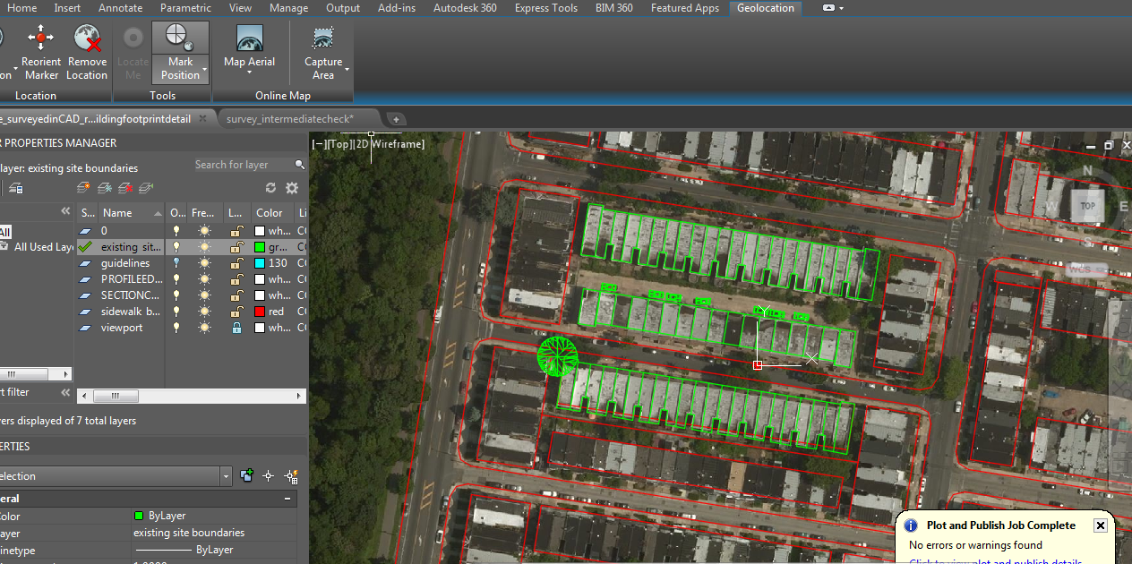
I was considering another workaround, and then found that using the capture area under the Geolocation tab works just fine. By selecting the image object your also given control over display type and resolution.
I'm using autocad 2015 and have installed the geolocation hotfix.
Hope that helps
Message 13 of 13
01-13-2015
03:26 PM
- Mark as New
- Bookmark
- Subscribe
- Mute
- Subscribe to RSS Feed
- Permalink
- Report
01-13-2015
03:26 PM
@ylaimoun wrote:
I was considering another workaround, and then found that using the capture area under the Geolocation tab works just fine. By selecting the image object your also given control over display type and resolution.
I'm using autocad 2015 and have installed the geolocation hotfix.
Hope that helps
Capture is only in 2015 versions of AutoCAD 2014 had the view only. The OP is using 2014 version. Also if the OP sees this there is a Canadian version of the National Maps for the USA if you google for it. (I lost the link to it years ago.)
Murph
Supporting the troops daily.

Supporting the troops daily.
Reply
Topic Options
- Subscribe to RSS Feed
- Mark Topic as New
- Mark Topic as Read
- Float this Topic for Current User
- Bookmark
- Subscribe
- Printer Friendly Page

