Community
- Forums Home
- >
- Infrastructure Map Server Community
- >
- Infrastructure Map Server Forum
- >
- GeoRest PUT with AIMS 2013
Infrastructure Map Server Forum
Welcome to Autodesk’s Infrastructure Map Server Forums. Share your knowledge, ask questions, and explore popular Infrastructure Map Server topics.
Turn on suggestions
Auto-suggest helps you quickly narrow down your search results by suggesting possible matches as you type.
Reply
Topic Options
- Subscribe to RSS Feed
- Mark Topic as New
- Mark Topic as Read
- Float this Topic for Current User
- Bookmark
- Subscribe
- Printer Friendly Page
Message 1 of 8
08-02-2012
03:27 PM
- Mark as New
- Bookmark
- Subscribe
- Mute
- Subscribe to RSS Feed
- Permalink
- Report
08-02-2012
03:27 PM
Hi All, has anyone tried a PUT with XML with GeoRest with AIMS 2013?
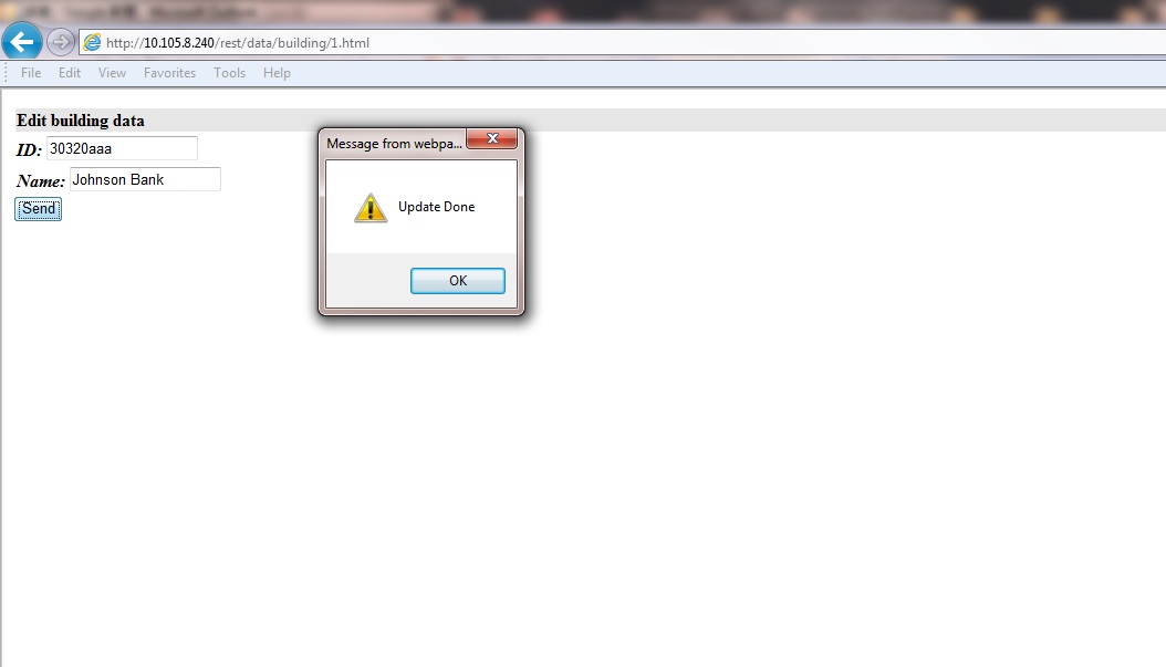
I am getting an "Update Done" with a responseText but the data actually isn't updating.
Any clues? I am using IIS 7.5
Solved! Go to Solution.
Solved by gluckett. Go to Solution.
7 REPLIES 7
Message 2 of 8
09-12-2012
09:36 PM
- Mark as New
- Bookmark
- Subscribe
- Mute
- Subscribe to RSS Feed
- Permalink
- Report
09-12-2012
09:36 PM
Steps to reproduce:
1. Modify the existing restcfg.xml in the C:\Program Files\Autodesk\Autodesk Infrastructure Web Server Extension 2013\www\GeoREST\conf\Sheboygan\Property\ folder to (A) point to AIMS and (B) Make XML editable:
<Resource uripart="property">
<Source type="MapGuide">
<FeatureSource>Library://Samples/Sheboygan/Data/Parcels.FeatureSource</FeatureSource>
<FeatureClass>SHP_Schema:Parcels</FeatureClass>
<ServerIp>127.0.0.1</ServerIp>
<ServerPort>2802</ServerPort>
</Source>
<Representation renderer="JSON" pattern=".json"/>
<Representation renderer="XML" pattern=".xml">
<Method name="GET" />
<Method name="PUT" />
<Method name="POST" />
<Method name="DELETE" />
</Representation>
2. Restart IIS to refresh the Config in GeoRest
3. Test the site to make sure you can see the parcel data:

4. Now write the PUT code to change the RACRE from 14.25 to 500
<script language=javascript>
var xml='<?xml version="1.0" encoding="UTF-8" ?><FeatureSet><Features><Feature>';
xml=xml+ '<Property><Name>RACRE</Name>';
xml=xml+ '<Value>500</Value></Property>';
xml=xml+ '</Feature></Features></FeatureSet>';
var xmlhttp;
if (window.XMLHttpRequest)
{
xmlhttp=new XMLHttpRequest();
xmlhttp.onreadystatechange = function(evt)
{
if(this.readyState == 4)
{
alert(this.responseText);
}
};
xmlhttp.open("PUT",'http://localhost/rest/data/property/1.xml',true);
xmlhttp.setRequestHeader("Content-Type","application/xml; charset=UTF-8");
xmlhttp.send(xml);
}
</script>
This returns "Update Done" but the data actually does not update (this worked with MG2011)
Load the 1.html to verify
Message 3 of 8
10-06-2012
05:45 AM
- Mark as New
- Bookmark
- Subscribe
- Mute
- Subscribe to RSS Feed
- Permalink
- Report
10-06-2012
05:45 AM
Aha! You need to remove the read-only tag - unfortunately, you have to install MapGuide Maestro because there is not an option (at least I can't find it) in Autodesk Infrastructure Studio 2013 to remove this flag from the Datasource.

Message 4 of 8
07-03-2014
12:21 AM
- Mark as New
- Bookmark
- Subscribe
- Mute
- Subscribe to RSS Feed
- Permalink
- Report
07-03-2014
12:21 AM
Hi Gluckett,
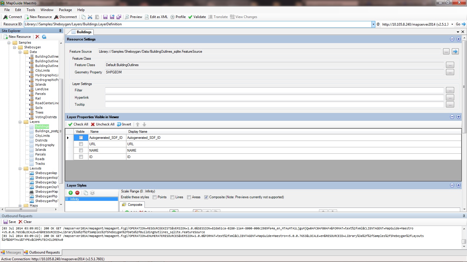
I still cannot make the PUT - Georest work! I created a new feature source which the data source is in sqlite format. I have tried to use SDF, SQLite. I using AIMS 2014 and the server is Windows Server 2008 R2 64-bit.
The restcfg.xml is:
<Resource uripart="building">
<Source type="MapGuide">
<FeatureSource>Library://Samples/Sheboygan/Data/BuildingOutlines.FeatureSource</FeatureSource>
<FeatureClass>SHP_Schema:BuildingOutlines</FeatureClass>
</Source>
<Representation renderer="JSON" pattern=".json"/>
<Representation renderer="XML" pattern=".xml"><Method name="PUT" /><Method name="POST" /><Method name="GET" /></Representation>
<Representation renderer="Template" pattern=".html" mimetype="text/html" >
<Templates section="BUILDING" prefix="BUILDING_">
<Many file="building_map_html_many.tpl" />
<Single file="building_map_html_single.tpl" />
<None file="building_map_html_none.tpl" />
<Error file="building_map_html_error.tpl" />
</Templates>
<Method name="GET" defaultcount="20" maxcount="500" />
</Representation>
The building_map_html_single.tpl is:
<html> <head> <meta http-equiv="Content-Type" content="text/html; charset=utf-8"> <link rel="stylesheet" type="text/css" href="/css/voka_int.css"> {{#BUILDING}} </head> <script> function UpdateFeature() { var xml = '<?xml version="1.0" encoding="UTF-8"?><FeatureSet><Features><Feature>'; xml = xml+'<Property><Name>NAME</Name><Value>'+document.getElementById('feature_NAME').value+'</Value></Property>'; xml = xml+'</Feature></Features></FeatureSet>';
var xmlhttp;
if (window.XMLHttpRequest)
{
xmlhttp=new XMLHttpRequest();
xmlhttp.onreadystatechange = function(evt)
{
if(this.readyState == 4)
{
alert(this.responseText);
}
};
xmlhttp.open("PUT",'/rest/data/building/{{BUILDING_ID}}.xml',true);
xmlhttp.setRequestHeader("Content-Type","application/xml; charset=UTF-8");
xmlhttp.send(xml);
}
} </script>
<table width="100%" height="50" id="feature_TABLE" class="mainfont">
<tr>
<th height="10" align="left" valign="left" bgcolor="#E6E6E6" >Edit building data</th>
</tr>
<tr>
<td class="mainfont" height="10" >
<strong ><em>ID: </em></strong><input type="text" name="feature_ID" id="feature_ID" value="{{BUILDING_ID}}" size="17"/></td>
</tr>
<tr>
<td class="mainfont" height="10" >
<strong ><em>Name: </em></strong><input type="text" name="feature_NAME" id="feature_NAME" value="{{BUILDING_NAME}}" size="17"/></td>
</td>
</tr>
</table>
<input type="button" name="send" id="button" value="Send" onClick="UpdateFeature()" size="17"/>
{{/BUILDING}}
</td>
</tr>
</table> </body> </html>
I found the feature class of Maestro is "Default: BuildingOutlines". It is not work if I change the feture class of restcfg.xml file to "Default: BuildingOutlines. Is there anything missing?
Message 5 of 8
07-03-2014
06:52 AM
- Mark as New
- Bookmark
- Subscribe
- Mute
- Subscribe to RSS Feed
- Permalink
- Report
07-03-2014
06:52 AM
Make sure your SQLLITE file is editable in Windows Security (perhaps try "ALL USERS" - then restrict as you go).
Message 6 of 8
07-03-2014
06:51 PM
- Mark as New
- Bookmark
- Subscribe
- Mute
- Subscribe to RSS Feed
- Permalink
- Report
07-03-2014
06:51 PM
Thanks. I have grant the permission with write to the user "Everyone" and restart the machine. Finally It still cannot be updated via the georest! 😞
Message 8 of 8
07-13-2014
05:44 PM
- Mark as New
- Bookmark
- Subscribe
- Mute
- Subscribe to RSS Feed
- Permalink
- Report
07-13-2014
05:44 PM
The data can be displayed without any problem. Should I use the SDF file directly instead of <FeatureSource>Library://GEOTECHNICAL/Slope.FeatureSource</FeatureSource>?
Thanks 🙂
Reply
Topic Options
- Subscribe to RSS Feed
- Mark Topic as New
- Mark Topic as Read
- Float this Topic for Current User
- Bookmark
- Subscribe
- Printer Friendly Page
