Community
- Forums Home
- >
- Community Archive - Read Only
- >
- Ecotect Analysis Community(Read Only)
- >
- Ecotect Analysis Forum(Read Only)
- >
- HELP! trying to do thermal analysis of a 500x500 meter city!
Ecotect Analysis Forum (Read Only)
Turn on suggestions
Auto-suggest helps you quickly narrow down your search results by suggesting possible matches as you type.
HELP! trying to do thermal analysis of a 500x500 meter city!
0 REPLIES 0
Reply
Topic Options
- Subscribe to RSS Feed
- Mark Topic as New
- Mark Topic as Read
- Float this Topic for Current User
- Bookmark
- Subscribe
- Printer Friendly Page
Message 1 of 1
12-20-2012
05:19 AM
- Mark as New
- Bookmark
- Subscribe
- Mute
- Subscribe to RSS Feed
- Permalink
- Report
12-20-2012
05:19 AM
HELP! trying to do thermal analysis of a 500x500 meter city!
Hi
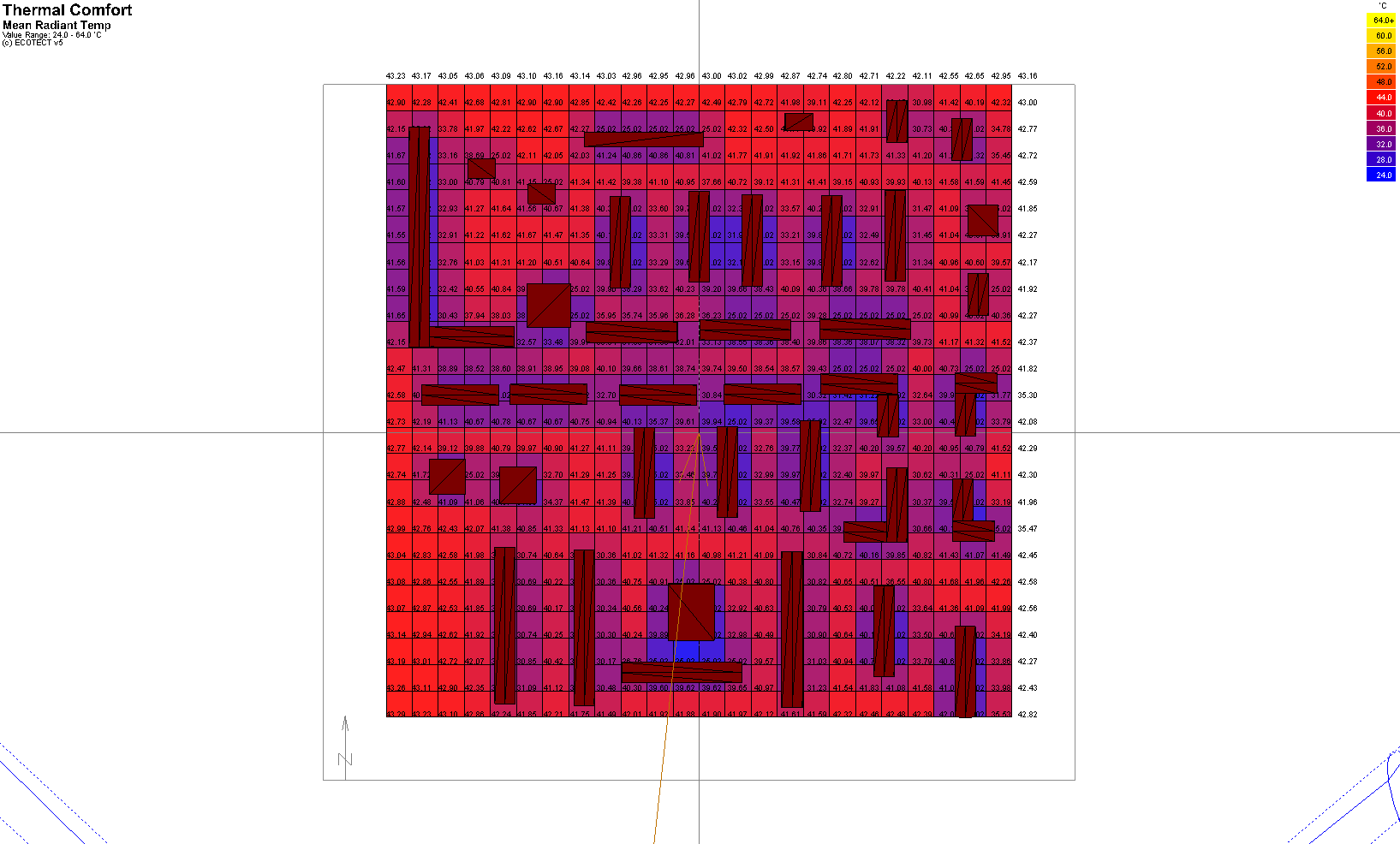
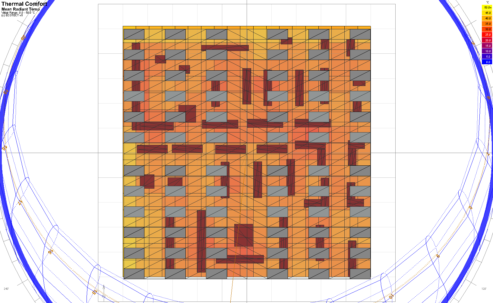
I have been using ecotect for 3 months now. But I have never tried the thermal comfot or the spatial comfort. I am doing my thesis in architecture about how a roof can help a city over all enviroment. for example if you have a roof over the city in high temperatured cities like dubai life standards will rise. So to make this short I have been doing spatial comfort analysis in the coldest and hottest months. the site is a 500X500 m site with at least 60 houses(4 floor each) I dont care about the thermal comfort inside the houses but I want to see the common places like streets or open spaces thermal comfort rates.
I tired this for example for Moscow, which the highest temperatures in summer are around 24 to 30 degrees, and i get an stonishing 50 degress??!!!! even in the winter the coldest is around -11 but in the spatial comfort i get the lowest -1???!!!
BTW I put the buildings all in one zone called the city and i put it as a thermal zone with natural ventilations.
what am I doing wrong?? does this mean my results for dailylight shading and insolations are all wrong too?? or is the spatial comfort just harder to set then the others?
I will attach two files to make it easier to understand what I mean. the MTH attachment is moscows normal spatial, and the MTR25, is moscows spatial comfort when there is 20meter high roof with 25% solar collectors installed on it.
I am really confused with this. can someone help me please?
0 REPLIES 0
Reply
Topic Options
- Subscribe to RSS Feed
- Mark Topic as New
- Mark Topic as Read
- Float this Topic for Current User
- Bookmark
- Subscribe
- Printer Friendly Page
