Community
- Forums Home
- >
- AutoCAD Map 3D Community
- >
- AutoCAD Map 3D Forum
- >
- Objects returned from a Data query do not appear with their related text
AutoCAD Map 3D Forum
Welcome to Autodesk’s AutoCAD Map 3D Forums. Share your knowledge, ask questions, and explore popular AutoCAD Map 3D topics.
Turn on suggestions
Auto-suggest helps you quickly narrow down your search results by suggesting possible matches as you type.
Objects returned from a Data query do not appear with their related text
3 REPLIES 3
Reply
Topic Options
- Subscribe to RSS Feed
- Mark Topic as New
- Mark Topic as Read
- Float this Topic for Current User
- Bookmark
- Subscribe
- Printer Friendly Page
Message 1 of 4
04-05-2012
12:12 AM
- Mark as New
- Bookmark
- Subscribe
- Mute
- Subscribe to RSS Feed
- Permalink
- Report
04-05-2012
12:12 AM
Objects returned from a Data query do not appear with their related text
We are using AutoCAD Map 3D 2011 (Service Pack 2 - Version 3). This is replicable on multiple machines in multiple OS environments.
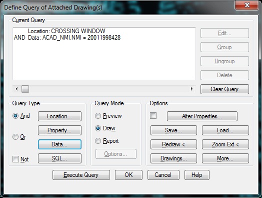
We attach a source drawing, run a query on Object Data but when that data appears in Model space it appears without any of the accompanying text for that object.
You can then execute the same query with a crossing window which brings in the surrounding objects including their text, but the original object still does not have its text. If you delete the object and re-run the query with the crossing window again, then the object appears with its text.
This is a nightmare for the users because if they want to search on a specific object, and then have to delete it to get it back with the text, they then have to search for the item in amongst all the other items. This kind of defeats the purpose of querying that object in the first place.
Is this just the way AutoCAD functions, or are we doing something wrong in our process sequence for querying the object data?
I've attached screenshots.
3 REPLIES 3
Message 2 of 4
04-05-2012
04:02 AM
- Mark as New
- Bookmark
- Subscribe
- Mute
- Subscribe to RSS Feed
- Permalink
- Report
Message 3 of 4
04-09-2012
02:20 PM
- Mark as New
- Bookmark
- Subscribe
- Mute
- Subscribe to RSS Feed
- Permalink
- Report
04-09-2012
02:20 PM
Please excuse the delayed response, Easter weekend and all that.
Can you please be a bit more descriptive in regards to use of the SDF file? As an organisation we are only just now implementing AutoCAD at any level, but Map is breaking new ground entirely for us. Looking at our source drawings we do have SDF files associated, but I'm just not sure how you mean to utilise them to resolve our issue.
Message 4 of 4
04-10-2012
02:13 AM
- Mark as New
- Bookmark
- Subscribe
- Mute
- Subscribe to RSS Feed
- Permalink
- Report
04-10-2012
02:13 AM
I'll try not knowing just what your dealing with. For example if your drawing objects are roads in a county andhave object data such as streetname, width, date of last pavement, & town in a dwg and you want to query roads for one town, you are attaching the road dwg and querying by the town name and then fiddling around trying to get the lables to display as you wnat them. Export the roads to a sdf file with any properties , length is one property, and object data you may need. You then dataattach the sdf and query in the roads for the town. Use style to set the road display as you want it based on the object data values. When the display is as you want it, save the layer to a *.layer file in a directory where you can find it easily ie GIS_data/Layer/Roads/MytownRoad.Layer. Now when you need the roads for MyTown you just drag and drop the MytownRoad.layer into your map and the roads are displayed as you wanted.
This gets away from the whole process you're going thru now. There are tutorials in the Map help. I would also suggest you upgrade to Map3D 2013 ASAP as there are some problems in the 2011 version that may be causing your problem.
dave
Reply
Topic Options
- Subscribe to RSS Feed
- Mark Topic as New
- Mark Topic as Read
- Float this Topic for Current User
- Bookmark
- Subscribe
- Printer Friendly Page

