Community
- Forums Home
- >
- AutoCAD Map 3D Community
- >
- AutoCAD Map 3D Forum
- >
- Re: AutoCAD Map 3D 2013 - Editing DXF maps
AutoCAD Map 3D Forum
Welcome to Autodesk’s AutoCAD Map 3D Forums. Share your knowledge, ask questions, and explore popular AutoCAD Map 3D topics.
Turn on suggestions
Auto-suggest helps you quickly narrow down your search results by suggesting possible matches as you type.
Reply
Topic Options
- Subscribe to RSS Feed
- Mark Topic as New
- Mark Topic as Read
- Float this Topic for Current User
- Bookmark
- Subscribe
- Printer Friendly Page
Message 1 of 14
11-26-2013
09:11 AM
- Mark as New
- Bookmark
- Subscribe
- Mute
- Subscribe to RSS Feed
- Permalink
- Report
11-26-2013
09:11 AM
AutoCAD Map 3D 2013 - Editing DXF maps
Those of you in the Oil & Gas biz - please help! I'm new to AutoCAD, and especially new to AutoCAD Map 3D. I need to make a plat showing a well location. When using Petra or DrillingInfo, a map can br printed to a DXF. DrillingInfo puts out a DXF with just the 0 layer, and the well spots come in as polyline circles. The DXF Petra puts out opens with different layers and symbology, which I like. It's just that the well spots are blocks, which I do not understand. When I open the Petra map with AutoCAD Map 3D, my well spots are unitless block references, and are tiny specks. I need to resize them so they can be seen. Why can't I figure this out??
13 REPLIES 13
Message 2 of 14
11-26-2013
01:44 PM
- Mark as New
- Bookmark
- Subscribe
- Mute
- Subscribe to RSS Feed
- Permalink
- Report
11-26-2013
01:44 PM
Your blocks are using different units. They are being scaled (0.293). You can change the scale in the properties window (all 4 at once since they have different names). That is a quick and easy fix for a 1 off.
A more permanent fix is to make sure the block definitions are using the same units. Note that this just doesn't work with lat/long.
Message 3 of 14
11-26-2013
02:22 PM
- Mark as New
- Bookmark
- Subscribe
- Mute
- Subscribe to RSS Feed
- Permalink
- Report
11-26-2013
02:22 PM
I tried changing the x and y scales to 100, and it still doesn't seem to change. Does the Block Unit being "Unitless" have an effect on this?
Thanks for your help!
Thanks for your help!
Message 4 of 14
11-26-2013
02:56 PM
- Mark as New
- Bookmark
- Subscribe
- Mute
- Subscribe to RSS Feed
- Permalink
- Report
11-26-2013
02:56 PM
NP. You have to make sure the units are "unitless" before you dxfin (create a template if you have to do this several times).
You can also try block edit in the destination file, but it's a PITA if there are several blocks with different names. You can also create a block with a big yellow circle or something and use block replace (xpress tools).
Message 5 of 14
12-03-2013
07:47 AM
- Mark as New
- Bookmark
- Subscribe
- Mute
- Subscribe to RSS Feed
- Permalink
- Report
12-03-2013
07:47 AM
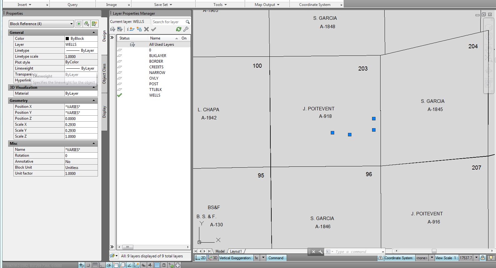
So I opened a blank dwg, set the units to unitless, then used command dxfin, and selected all the well blocks. I changed the x and y scales to 100 in the properties window, but this only changed the size of two of the block references. The remaining blocks are still specks. All the blocks appear to have the same properties in the properties window. Do I need to make some changes elsewhere?
Message 6 of 14
12-03-2013
12:54 PM
- Mark as New
- Bookmark
- Subscribe
- Mute
- Subscribe to RSS Feed
- Permalink
- Report
12-03-2013
12:54 PM
Does a Match Properties (MA or MATCHPROP command) from the desired looking block to the tiny one change results?
What about a REGENALL?
Or do the blocks start to look alike after you save, close, and reopen the drawing?
Phil Borycens
Message 7 of 14
12-03-2013
03:22 PM
- Mark as New
- Bookmark
- Subscribe
- Mute
- Subscribe to RSS Feed
- Permalink
- Report
12-03-2013
03:22 PM
I'm thinking the blocks are made up of autocad points with the point symbol not set to a symbol that you can see, Type in DDPTYPE and pick a different symbol and/or PDSIZE and set the size up.
Murph
Supporting the troops daily.

Supporting the troops daily.
Message 8 of 14
12-04-2013
04:31 AM
- Mark as New
- Bookmark
- Subscribe
- Mute
- Subscribe to RSS Feed
- Permalink
- Report
12-04-2013
04:31 AM
Not sure if it matters but you have not set a coordinate system in the map in your screen shot. Is there a CS involved somehow? Possibly it needs to be set before or after the dxf data is added?
dave
Message 9 of 14
12-04-2013
06:32 AM
- Mark as New
- Bookmark
- Subscribe
- Mute
- Subscribe to RSS Feed
- Permalink
- Report
12-04-2013
06:32 AM
The Petra map that I exported the DXF out of is set to NAD 27 Texas State Plane South Zone. When open the DXF in Map3D no CS is assigned. Therefore, I guess the DXF does not contain a spatial reference? Either way I tried assigning the CS in Map3D, but it does not seem to change the blocks. I then tried changing the units feet since I set the CS to State Plane, but that doesn't seem to help either.
Message 10 of 14
12-04-2013
06:41 AM
- Mark as New
- Bookmark
- Subscribe
- Mute
- Subscribe to RSS Feed
- Permalink
- Report
12-04-2013
06:41 AM
Just tried MA, and it didn''t change anything. That's probably because all properties in the Properties window are already all the same for each block reference. I went ahead and did a REGENALL, saved, closed and reopened. No change.
Message 11 of 14
12-04-2013
06:48 AM
- Mark as New
- Bookmark
- Subscribe
- Mute
- Subscribe to RSS Feed
- Permalink
- Report
12-04-2013
06:48 AM
I've been wondering about the CS factor too. When the drawing opens up, the view scale is 1:12.5521 and the screen look blank. I have to zoom to full extents to see the drawing, and the view scale changes to 1: 21027.1.
I'm not sure how to interpret this since the units are "unitless."
I'm not sure how to interpret this since the units are "unitless."
Message 12 of 14
12-04-2013
07:05 AM
- Mark as New
- Bookmark
- Subscribe
- Mute
- Subscribe to RSS Feed
- Permalink
- Report
12-04-2013
07:05 AM
Ok, tried the DDPTYPE and it looks like you were right, in that they are set to a single point, sized 5% relative to Screen. I tried changing the style and increasing the size to 100% relative to Screen size - no change. Then tried changing size to 1000 Absolute units (which I guess doesn't make a difference since the units are "unitless"?). No change.
I was excited thiugh, I though that might have been it. 🙂
Message 13 of 14
12-04-2013
03:05 PM
- Mark as New
- Bookmark
- Subscribe
- Mute
- Subscribe to RSS Feed
- Permalink
- Report
12-04-2013
03:05 PM
@lmclaughlin wrote:
Ok, tried the DDPTYPE and it looks like you were right, in that they are set to a single point, sized 5% relative to Screen. I tried changing the style and increasing the size to 100% relative to Screen size - no change. Then tried changing size to 1000 Absolute units (which I guess doesn't make a difference since the units are "unitless"?). No change.
I was excited thiugh, I though that might have been it. 🙂
Try opening one of the blocks in the blockeditor BEDIT and check there, change it then save the block and regen.
Murph
Supporting the troops daily.
Supporting the troops daily.
Message 14 of 14
12-04-2013
03:08 PM
- Mark as New
- Bookmark
- Subscribe
- Mute
- Subscribe to RSS Feed
- Permalink
- Report
12-04-2013
03:08 PM
@lmclaughlin wrote:
The Petra map that I exported the DXF out of is set to NAD 27 Texas State Plane South Zone. When open the DXF in Map3D no CS is assigned. Therefore, I guess the DXF does not contain a spatial reference
The old DXF format does not hold any CS data and I would say Petra is using the old format still.
Murph
Supporting the troops daily.
Supporting the troops daily.
Reply
Topic Options
- Subscribe to RSS Feed
- Mark Topic as New
- Mark Topic as Read
- Float this Topic for Current User
- Bookmark
- Subscribe
- Printer Friendly Page

