Community
- Forums Home
- >
- Civil 3D Community
- >
- Civil 3D Forum
- >
- Re: Unable to assign coordinate system when importing LAS files.
Civil 3D Forum
Welcome to Autodesk’s Civil 3D Forums. Share your knowledge, ask questions, and explore popular AutoCAD Civil 3D topics.
Turn on suggestions
Auto-suggest helps you quickly narrow down your search results by suggesting possible matches as you type.
Reply
Topic Options
- Subscribe to RSS Feed
- Mark Topic as New
- Mark Topic as Read
- Float this Topic for Current User
- Bookmark
- Subscribe
- Printer Friendly Page
Message 1 of 6
Anonymous
1258 Views, 5 Replies
08-08-2012
02:41 AM
- Mark as New
- Bookmark
- Subscribe
- Mute
- Subscribe to RSS Feed
- Permalink
- Report
08-08-2012
02:41 AM
Unable to assign coordinate system when importing LAS files.
Hi,
I have been trying to import LAS files via Civil 3D 2011.
To do this I first turn the workspace to ''Tool based geospatial''. Then i assign a global coordinate system which is the same one as the LAS file i am importing. The in the task pane window (comand: mapwspace) under display manager tab i rightclick on map base --> data --> add point cloud data --> create new index and then choose the file I want to import. Here i have some trouble; in the create new index window i am unable to assign a coordinate system, i can find the one i need but i cant select it (or any other), it presists on staying unselected. I am able to create an index without a coordinate system but I need it with the right coordinates.
Have you had this problem?
Thank you
5 REPLIES 5
Message 2 of 6
08-08-2012
05:15 AM
- Mark as New
- Bookmark
- Subscribe
- Mute
- Subscribe to RSS Feed
- Permalink
- Report
08-08-2012
05:15 AM
Create the Point Cloud from your Prospector in Civil 3D (right-click on Point Cloud and Create), not doing the map functions. This may work better for you. In the wizard you will have the option to set the coordinate system.
Todd Rogers
Message 3 of 6
08-08-2012
06:45 AM
- Mark as New
- Bookmark
- Subscribe
- Mute
- Subscribe to RSS Feed
- Permalink
- Report
08-08-2012
06:45 AM
Thanks for the reply.
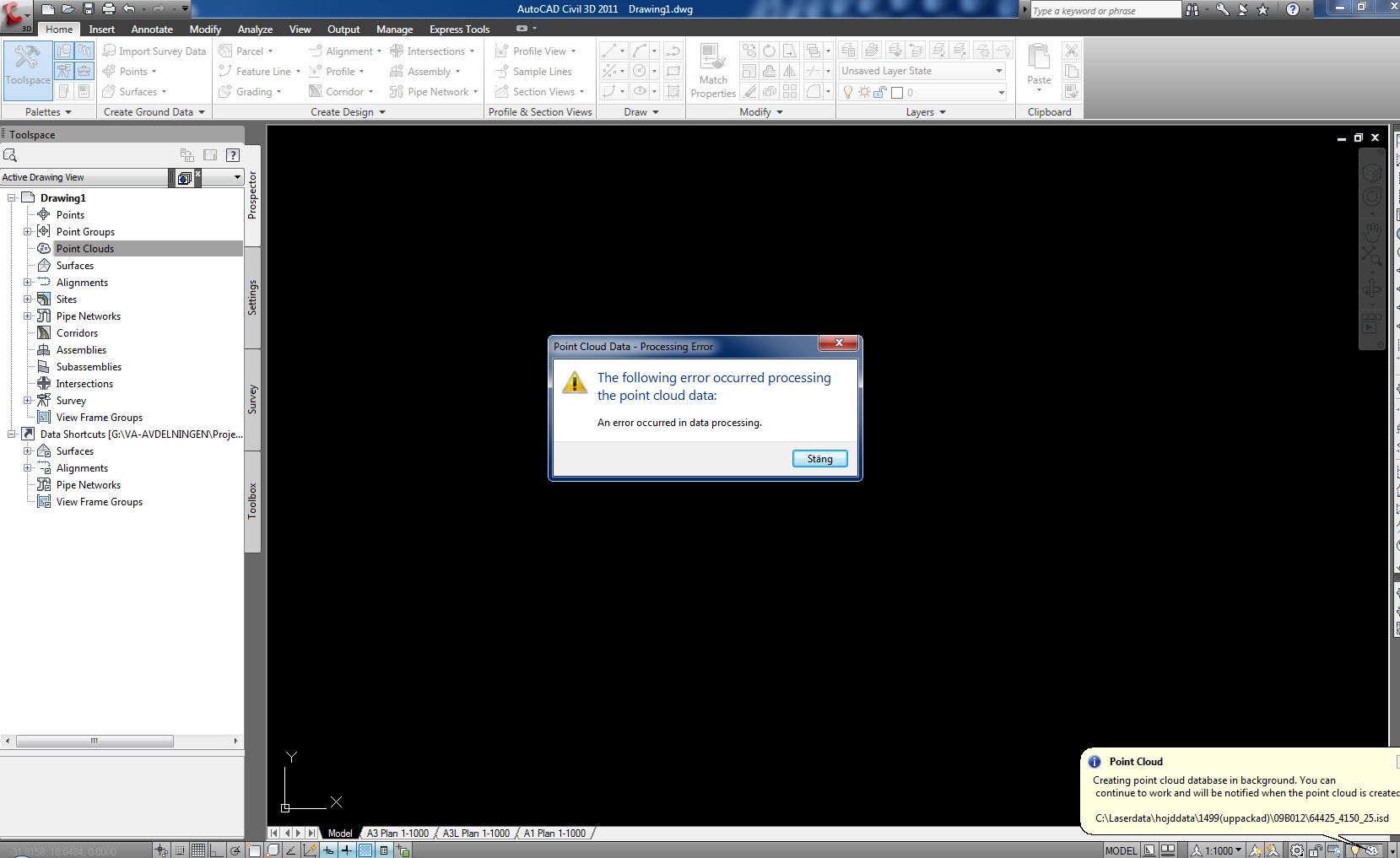
I followed your instrctions but i get an error box (see the attachment) right at the end of the creation process. Nontheless the isd file is created and i can import it and create a surface BUT the original LAS is not in the coordinate system I want and I am unable to convert it to the right coordinate sys. Do you have any advice?
I have tried to simply change the global coordinate system after i have created the point cloud (thinking since its original coordinates have been set it should know how to convert properly) but it just dosent work.
Message 4 of 6
08-08-2012
06:48 AM
- Mark as New
- Bookmark
- Subscribe
- Mute
- Subscribe to RSS Feed
- Permalink
- Report
08-08-2012
06:48 AM
This usually occurs when using the wrong format. Is the LAS file small enough to attach here? If not, can you send it to me some other way? My email address is trogers@tcadsys.com.
Todd Rogers
Message 5 of 6
08-08-2012
02:58 PM
- Mark as New
- Bookmark
- Subscribe
- Mute
- Subscribe to RSS Feed
- Permalink
- Report
08-08-2012
02:58 PM
Is the goal to import your survey points in one coordinate system in order to translate it into another? If so, there is some information here. See reference as it should help you explore an alternate method to the "point cloud" method mentioned above. http://civil3dplus.wordpress.com/tag/coordinates/
Message 6 of 6
08-08-2012
11:08 PM
- Mark as New
- Bookmark
- Subscribe
- Mute
- Subscribe to RSS Feed
- Permalink
- Report
Reply
Topic Options
- Subscribe to RSS Feed
- Mark Topic as New
- Mark Topic as Read
- Float this Topic for Current User
- Bookmark
- Subscribe
- Printer Friendly Page

